|
| Title/Maker | Year | Measures | Price | |
|
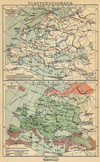 | Plantengeografie
by Winkler Prins | 1910 | 14 X 22 cm | 9 euro |
|
 | Natuurkundige overzichtskaart van Europa
by Winkler Prins | 1907 | 28 X 22 cm | 16 euro |
|
 | Geologische kaart van Middeleuropa
by Winkler Prins | 1907 | 28 X 22 cm | 23 euro |
|
 | Europe en 1789
by Giraldon Bovinet | 1830 | 37 X 22 cm cm | 32 euro |
|
 | Europa (index)
by Kuyper (Kuijper) | 1880 | 19 X 16 cm | 32 euro |
|
 | Europa na den val van Westromeinsche Rijk (476 n.Chr.); Rijk der Oostgothen (493-553)
by P.W.M. Trap | 1876 | 28 X 22 cm | 32 euro |
|
 | Duitschland in het jaar 1792
by P.W.M. Trap | 1876 | 28 X 22 cm | 32 euro |
|
 | Oost-Europa, Polen, Gebied der Duitsche Orde
by P.W.M. Trap | 1876 | 28 X 22 cm | 32 euro |
|
 | Europa in 1850
by P.W.M. Trap | 1876 | 22 X 28 cm | 32 euro |
|
 | Europa omtrent het jaar 511 n. Chr.
by De Erven Thierry en Mensing | 1858 | 31,5 X 22 cm | 37 euro |
|
 | Ethnografische kaart van Europa
by Winkler Prins | 1907 | 28 X 22 cm | 37 euro |
|
 | Europa (Staatkundige Verdeeling en Hoofdverkeerwegen)
by F. Bruins | 1884 | 28 X 22 cm | 37 euro |
|
 | Het klimaat van Europa (naar Fischer, Hann, Mohn, Wild en Wojeikov)
by F. Bruins | 1884 | 28 X 22 cm | 37 euro |
|
 | Europa (Volksdichtheid)
by F. Bruins | 1884 | 28 X 22 cm | 37 euro |
|
 | Europe
by Giraldon Bovinet | 1830 | 37 X 22 cm cm | 42 euro |
|
 | Tableau de l´Europe en 1821
by Vosgien, Ladvocat | 1830 | 18 X 11 cm | 42 euro |
|
 | L´Europe suivant les dernieres observations de l´acad royale des sciences
by Faure naar C. Buffier | 1789 | 18 X 15 cm | 42 euro |
|
 | Europa till Ofversigt af Ytbeskaffenheten
by Stieler | 1868 | 25,5 X 20 cm | 42 euro |
|
 | Europe, divisee en ses differens Etats
by Félix Delamarche | 1833 | 38 X28 cm cm | 52 euro |
|
 | L´Europe avant l´invasion des barbares
by Félix Delamarche | 1831 | 33 X 26 cm cm | 52 euro |
|
 | L´Europe divisée en ses différens états sous Charlemagne
by Félix Delamarche | 1831 | 34 X 26 cm cm | 52 euro |
|
 | Europe
by Swanston, Fullerton | 1870ca | 53 X 41 cm | 52 euro |
|
 | Europa omtrent het jaar 1810
by De Erven Thierry en Mensing | 1858 | 31.5 X 22 cm | 52 euro |
|
 | Europe
by Migeon, Sengteller, Desbuissons | 1881 | 37 X 30 cm | 83 euro |
|
 | Europae
by Schöning | 1763 | 31 X 19 cm cm | 94 euro |
|
 | Europe and its Empires, Kingdoms and States according to their Modern Divisions
by Thomas Kitchen | 1794 | 52.5 X 43.5 cm | 228 euro |
|
 | Nieuwe Geographische kaart van Europa
by August Friedrich Wilhelm Crome | 1783 | 70 X 53 cm | 2277 euro |
|
 | Historische kaarten van Europa II
by Winkler Prins | 1907 | 13,5 X 22 cm | sold |
|
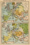 | Historische kaarten van Europa III
by Winkler Prins | 1907 | 13,5 X 22 cm | sold |
|
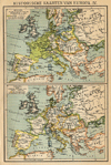 | Historische kaarten van Europa IV
by Winkler Prins | 1907 | 13,5 X 22 cm | sold |
|
 | Europe centrale
by Achille Meissas, A. Michelot | 1854 | 49.5 X 39.5 cm | sold |
|
 | REPRODUCTION: Europa
by Rumoldus Mercator | 1595 | 40 X 33 cm | sold |
|
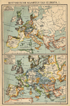 | Historische kaarten van Europa I
by Winkler Prins | 1907 | 13,5 X 22 cm | sold |
|
 | Europa aan het einde der 12e Eeuw
by De Erven Thierry en Mensing | 1858 | 13,5 X 22 cm | sold |
|
 | Europa aan het einde der 14e Eeuw
by De Erven Thierry en Mensing | 1858 | 13,5 X 22 cm | sold |
|
 | Europa, Politische übersicht
by Richard Andree | 1896 | 48 X 38 cm | sold |
|
 | Carte de l´Europe
by Dufour | 1833 | 42 X 35 cm cm | sold |
|
 | Europa
by A. Baedeker, Rotterdam | 1844 | 26 X 21 cm | sold |
|
 | Staatkundige overzichtskaart van Europa
by Winkler Prins | 1907 | 28 X 22 cm | sold |
|
 | Europe sous charlemagne
by Giraldon Bovinet | 1830 | 37 X 22 cm cm | sold |
|
 | Europe
by Poussielgue Frêres | 1870 | 33 X 24 cm cm | sold |
|
 | L'Europe
by Félix Delamarche | 1833 | 40 X 28 cm cm | sold |
|
 | Europa ten tijde van Karel den Groote
by De Erven Thierry en Mensing | 1858 | 31,5 X 22 cm | sold |
|
 | Europe, from the best authorities
by T. Tegg | 1814 | 24 X 20 cm | sold |
|
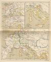 | Het Rijk der Franken 511 na Chr en 687-714; Italie; Europa onder Karel den Groote (766-814)
by P.W.M. Trap | 1876 | 28 X 22 cm | sold |
|
 | Europa ten tijde van Karel V 1526
by P.W.M. Trap | 1876 | 28 X 22 cm | sold |
|
 | Europa bij het begin der omwenteling in Frankrijk 1789
by P.W.M. Trap | 1876 | 28 X 22 cm | sold |
|
 | Napoleon´s keizerrijk in het jaar 1812
by P.W.M. Trap | 1876 | 28 X 22 cm | sold |
|
 | Europa (Oro-Hydrographisch)
by F. Bruins | 1884 | 28 X 22 cm | sold |
|
 | Europa
by P.W.M. Trap | 1872 | 28,5 X 23 cm | sold |
|
 | Europa (Ethnographie en Hoofdproducten)
by F. Bruins | 1884 | 28 X 22 cm | sold |
|
 | Europa omtrent het Jaar 1520
by De Erven Thierry en Mensing | 1858 | 31,5 X 22 cm | sold |
|
 | Europa van den dood van Frederik den Groote tot aan de Franse Omwenteling
by De Erven Thierry en Mensing | 1858 | 31,5 X 22 cm | sold |
|
 | Allexandri magni Macedonis Expeditio
by Papierformaat is 66 X 54 cm | 1700 | 47 X 36.5 cm | sold |
|
 | Europae Nova Tabula
by J. Janssonius, A. Goos | 1628 | 20 X 14 cm | sold |
|
 | Imperium Romanum Auth. Phil Briet. e societ Iesu
by Papierformaat is 66 X 54 cm\r\nKoeman: Ja-10-45 | 1700 | 51.5 X 38 cm | sold |
|
 | De Groote Volksverhuizingen
by De Erven en Mensing | 1858 | 31,5 X 22 cm | sold |
|
|
|


 follow us on facebook