Rediscover your world at Atlas and Map
The place for your antique maps, plans, books and prints
Antique maps of Poland


HOME - MAPS - PRINTS - BOOKS - INFO
Antique maps of Poland
last update: Feb-14-2022
Maps of Poland on atlasandmap.com
Title/MakerYearMeasuresPrice
thmbnail of Westrussland, Südliche HälfeWestrussland, Südliche Hälfe
by A. Thomas, G. Jungk
189650 X 40 cm23 euro
thmbnail of Provinzen West- Und OstpreussenProvinzen West- Und Ostpreussen
by G. Jungk.
189648 X 38 cm23 euro
thmbnail of Duitschland in ´t jaar 1512; De 10 kreitsen naar de verdeeling van keizer Maximiliaan 1, 1512Duitschland in ´t jaar 1512; De 10 kreitsen naar de verdeeling van keizer Maximiliaan 1, 1512
by P.W.M. Trap
187628 X 22 cm32 euro
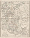
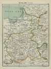
thmbnail of Europisch  Rusland en PolenEuropisch Rusland en Polen
by A. Baedeker
184426 X 21 cm42 euro
thmbnail of Noord-Duitschland en DenemarkenNoord-Duitschland en Denemarken
by P.W.M. Trap
187228,5 X 23 cm42 euro
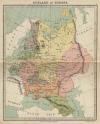
thmbnail of Rusland in EuropaRusland in Europa
by Emrik & Binger
187223 X 28,5 cm47 euro
thmbnail of Confédération Germanique, Royaume de Prusse, Empire d´Autriche, Royaume de PologneConfédération Germanique, Royaume de Prusse, Empire d´Autriche, Royaume de Pologne
by Félix Delamarche
183335 X 26 cm cm52 euro
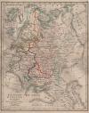
thmbnail of Europeesch Rusland en PolenEuropeesch Rusland en Polen
by D. Heyse, A. Baedeker
1850ca21 X 26 cm52 euro
thmbnail of Ungarn und GalizienUngarn und Galizien
by J. Walch
1805ca25 X 20 cm125 euro
thmbnail of Ducatus Pomeraniae cum magna Maris Balthici Et Provinc: adnex: parteDucatus Pomeraniae cum magna Maris Balthici Et Provinc: adnex: parte
by Matthias Seuter
1757ca26 X 19 cm145 euro
thmbnail of Tabula germaniae emendata recens per Nicolaum Joh. Piscatorem.Tabula germaniae emendata recens per Nicolaum Joh. Piscatorem.
by Nicolaas Visscher - Frederik de Wit
167055 X 47 cm187 euro
thmbnail of Oost- en West-PruissenOost- en West-Pruissen
by Winkler Prins
191027 X 22 cmsold
information about map on atlasandmap.com
thmbnail of Ungarn und GalizienUngarn und Galizien
by A. Brandrupp, Ch. Peip, M. Oschmann
189648 X 39 cmsold
information about map on atlasandmap.com
thmbnail of Kaart   Polen, Galizien, Ungern, Kroatien, Siebenbürgen, Moldau och Wallachiet.Kaart Polen, Galizien, Ungern, Kroatien, Siebenbürgen, Moldau och Wallachiet.
by Stieler
186822,5 X 21 cmsold
information about map on atlasandmap.com
thmbnail of Duitschland onder de saksiche en frankische Keizers tot 1138Duitschland onder de saksiche en frankische Keizers tot 1138
by P.W.M. Trap
187628 X 22 cmsold
information about map on atlasandmap.com
thmbnail of Les Etats de la couronne de PologneLes Etats de la couronne de Pologne
by Onbekend
1750ca21.5 X 16 cmsold
information about map on atlasandmap.com
thmbnail of regni poloniae et ducatus lithuaniae voliniae, podoliae ucraniae prussiae, livoniae et curlandiae			regni poloniae et ducatus lithuaniae voliniae, podoliae ucraniae prussiae, livoniae et curlandiae
by Wit, Frederik de
167056 X 48 cmsold
information about map on atlasandmap.com

Maps of regions in Poland on atlasandmap.com
RegionTitle/MakerYearMeasuresPrice

Rusland (Polen)
by Kuyper (Kuijper)
188020 X 15,5 cm27 euro

Provinz Schlesien
by Richard Andree
189650 X 39 cm23 euro

Silezië
by Winkler Prins
191027 X 22 cmsold

Plans of cities in Poland on atlasandmap.com
TownTitle/MakerYearMeasuresPrice
Świeradów-Zdrój
Flinsberg
by nn
1850ca15 X 11,5 cm26 euro
Jelenia Góra
Ruine Kynast
by NN
1860ca14 X 11 cm26 euro
Kołobrzeg
Das Ratthaus zu Colberg
by A.H. Payne
1850ca16 X 11,5 cm32 euro
Szczecin
Terminé par Basq
by J. Swebach, J. Duplessi-Bertaux
1810ca14 X 10 cm32 euro
Wrocław
Breslau in Farbenbild, Albrechtstrasse
by nn
1900ca9,5 X 14 cm16 euro
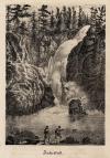
Zackenfall, Wodospad Kamieńczyka
Zackenfall
by nn
1850ca11 X 16 cm21 euro

HOME - MAPS - PRINTS - BOOKS - INFO
New:
Maps
Kaarten voor de geschiedenis der aardrijkskunde II (2)

Kuyper maps
Gemeente Gouda

Prints
Reinoud IIe agttiende heer van Brederode, door de Utrechtsche Bisschop, David van Bourgondien...

Townplans and views
Roermond: Ruremunda Gelriea opp.

Books and atlasses
FACSIMILE: Gemeente-Atlas van de provincie Friesland 1861

We are on facebook now:
follow us on facebook
for news, highlighted special items and items on your dutch roots.


sitemap | recent added | inspired by: kruisbestuiving: benut kennis optimaal - www.kuisbestuiving.nl | contact | RSS | | privacy