Maps of Germany on atlasandmap.com |
| Title/Maker | Year | Measures | Price | |
|
 | Germanië in de 2e eeuw na Chr.
by Winkler Prins | 1908 | 28 X 22 cm | 11 euro |
|
") | Duitsche Rijk (Natuurk. overzicht)
by Winkler Prins | 1907 | 29 X 22 cm | 16 euro |
|
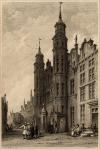
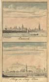
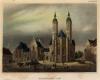
 | Lübeck
by Winkler Prins | 1909 | 22 X 14 cm | 16 euro |
|
") | Noord Duitschland (Westelijk)
by Kuyper (Kuijper) | 1880 | 15 X 20 cm | 19 euro |
|
") | Noord Duitschland (Oostelijk)
by Kuyper (Kuijper) | 1880 | 15 X 20 cm | 19 euro |
|
 | Allemagne
by Poussielgue Frêres | 1870 | 33 X 24 cm cm | 21 euro |
|
 | Prusse
by Poussielgue Frêres | 1870 | 33 X 24 cm cm | 21 euro |
|
 | Kaart Nordvestra Tyskland, Nederländerna och Belgien.
by Stieler | 1868 | 24,5 X 18,5 cm | 21 euro |
|
 | Kaart Sydvestra Tyskland och Schweiz.
by Stieler | 1868 | 21,5 X 17,5 cm | 21 euro |
|
 | Duitsland omtrent het midden der 10de eeuw
by De Erven Thierry en Mensing | 1858 | 31,5 X 22 cm | 21 euro |
|
 | Duitschland gedurende den 30 jarigen Oorlog
by De Erven Thierry en Mensing | 1858 | 31,5 X 22 cm | 21 euro |
|
 | Dorsten
by J.C. Sepp | 1773 | 15 X 11,5 cm | 21 euro |
|
 | Les Deux Cercles du Haut et Bas Rhin
by Buffier | 1739 | 14 X 18 cm | 21 euro |
|
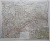
 | Südbayern, Tirol und Salzburg
by G. Jungk. | 1896 | 49 X 40 cm | 23 euro |
|
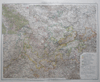
 | Rheinland und Westfalen, Fürstentümer Lippe und Grossherzogtum Luxemburg
by H. Mielisch, E. Umbreit | 1896 | 37 X 53 cm | 23 euro |
|
 | Deutschland. Physische übersicht
by Richard Andree | 1896 | 50 X 38 cm | 23 euro |
|
") | Duitsche Rijk (Staatkundig overzicht)
by Winkler Prins | 1907 | 29 X 22 cm | 26 euro |
|
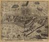
 | A Map Shewing the Situation of the French & Allied Armies in Germany
by J. Gibson | 1760 | 19 X 11 cm | 26 euro |
|
 | Koesfeld
by J.C. Sepp | 1773 | 14,5 X 11,5 cm | 26 euro |
|
 | Plan explanatory of the Battle of Freyberg
by nn | 1799 | 22 X 16 cm | 26 euro |
|
 | Nieuwe kaart van Duitsland verdeelt in zijn thien Kreitzen
by Isaak Tirion | 1740 | 34 X 28 cm | 32 euro |
|
 | Duitschland en Frankrijk ten tijde van het Rijnverbond
by De Erven Thierry en Mensing | 1858 | 31,5 X 22 cm | 32 euro |
|
 | Empire d´Allemagne
by nn | 1746 | 16 X 14 cm | 32 euro |
|
 | Wesel
by J.C. Sepp | 1773 | 15 X 11,5 cm | 32 euro |
|
 | De l´Europe, Cercle de Souabe
by A. Manesson Mallet | 1683 | 12 X 16 cm | 32 euro |
|
 | Duitschland in ´t jaar 1512; De 10 kreitsen naar de verdeeling van keizer Maximiliaan 1, 1512
by P.W.M. Trap | 1876 | 28 X 22 cm | 32 euro |
|
 | Duitschland bij het begin van den dertigjarigen oorlog 1618
by P.W.M. Trap | 1876 | 28 X 22 cm | 32 euro |
|
 | Brandenburg, Pruisen en Oostenrijk
by P.W.M. Trap | 1876 | 28 X 22 cm | 32 euro |
|
, Berlijn") | Duitschland (Natuurlijke gesteldheid), Berlijn
by F. Bruins | 1884 | 28 X 22 cm | 32 euro |
|
 | Duitschland volgens de Nieuwste waarnemingen. Opgesteld te Amsterdam by Holtrop.
by J. van Jagen | 1780ca | 12,5 X 10 cm | 37 euro |
|
 | Plan of the Battle of Minden, Corrected from the Proceedings before the Court Martial
by nn | 1760 | 26 X 19 cm | 37 euro |
|
 | Germania Antiqua
by F Delamarche | 1830 c | 28 X 24 CM cm | 42 euro |
|
 | Duitsland en Zwitserland
by A. Baedeker | 1844 | 26,5 X 21 cm | 42 euro |
|
") | Empire d´Allemagne (carte d´ensemble)
by Migeon, Sengteller, Desbuissons | 1881 | 27.5 X 40 cm | 42 euro |
|
") | Empire d´Allemagne (Prusse et autres états du Nord)
by Migeon, Sengteller, Desbuissons | 1881 | 27.5 X 40 cm | 42 euro |
|
 | L´Empire D´Allemagne
by A. Faure | 1744 | 17,5 X 14 cm | 42 euro |
|
 | Germany
by T. Kitchin | 1770ca | 22,5 X 18 cm | 42 euro |
|
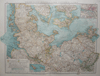
 | Noord-Duitschland en Denemarken
by P.W.M. Trap | 1872 | 28,5 X 23 cm | 42 euro |
|
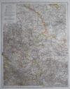
 | Zuid-Duitschland en Zwitserland
by Emrik & Binger | 1872 | 28,5 X 23 cm | 42 euro |
|
 | Generale Kaart van Duytschland; L´Allemagne avec ses Confins et ses Dependances
by Jan de Lat | 1735 | 17 X 15 cm | 47 euro |
|
 | Populorum Germaniae inter Rhenum et Albim Descript ut inter Coesaris et Traiani imperia Incoluerunt
by P. Clüver | 1700ca | 21 X 16 cm | 47 euro |
|
 | A Map of the Northern Part of the Circle of Lower Saxony
by T. Kitchin | 1750ca | 27 X 14,5 cm | 47 euro |
|
 | A map of the Southern Part of the Circle of Lower Saxony which may perhaps soon become a Seat of War
by T. Kitchin | 1765ca | 26 X 18 cm | 47 euro |
|
 | Confédération Germanique, Royaume de Prusse, Empire d´Autriche, Royaume de Pologne
by Félix Delamarche | 1833 | 35 X 26 cm cm | 52 euro |
|
 | Germania Antiqua et Regiones Danubium inter et Mare Adriaticum Contentoe
by Félix Delamarche | 1833 | 31 X 26 cm cm | 52 euro |
|
 | Germaniae Magnae
by Mensone Alting | 1725 | 42 X 32 cm | 52 euro |
|
 | Sud-Westliches Deutschland und die Schweiz
by C. Vogel | 1878 | 39,5 X 31 cm | 52 euro |
|
 | Van Straalsond tot Danzig
by nn | 1870 | 40 X 32 cm | 63 euro |
|
 | Carte Physique d´Allemagne
by Chanlaire and Mentelle | 1805 | 43 X 32.5 cm | 83 euro |
|
 | Ducatus Pomeraniae cum magna Maris Balthici Et Provinc: adnex: parte
by Matthias Seuter | 1757ca | 26 X 19 cm | 145 euro |
|
 | Cleve et Murs
by Jodocus Hondius, Gerard Mercator | 1608ca | 18.5 X 14 cm | 187 euro |
|
 | Tabula germaniae emendata recens per Nicolaum Joh. Piscatorem.
by Nicolaas Visscher - Frederik de Wit | 1670 | 55 X 47 cm | 187 euro |
|
 | Electoratus Moguntinus ut et Palatin: Infer. Hassiae et Fluminis Moeni
by J.B. Homann | 1720ca | 48,5 X 58 cm | 207 euro |
|
 | Circuli Franconiae pars orientalis et potior
by J.B. Homann | 1750ca | 49 X 58 cm | 207 euro |
|
 | Carte Politique de l'empire d'allemagne
by Mentelle and Chanlaire | 1805 | 42 X 32 CM cm | sold |
|
 | REPRODUCTION: Ducatus Sleswici pars Borealis
by Joan Mejerus | 1662 | 60.5 X 41.5 cm | sold |
|
 | Duitschland van 1355-1500
by De Erven Thierry en Mensing | 1858 | 13,5 X 22 cm | sold |
|
") | Duitschland (Staatkundige kaart)
by F. Bruins | 1884 | 28 X 22 cm | sold |
|
 | Germania Ptolemaei
by Weigel | 1720 | 37 X 30 cm | sold |
|
 | Germaniae Veteris
by P. van der Keere (P. Kaerius) | 1650ca | 20 X 16 cm | sold |
|
 | Duitschland onder de saksiche en frankische Keizers tot 1138
by P.W.M. Trap | 1876 | 28 X 22 cm | sold |
|
") | Duitschland (Geologische kaart)
by F. Bruins | 1884 | 28 X 22 cm | sold |
|
 | Alpenkaart
by F. Bruins | 1884 | 28 X 22 cm | sold |
|
 | De noordelijke kustlanden van Duitschland van Emden tot nabij Straalsond
by nn | 1870 | 40 X 32 cm | sold |
|
 | Totius Fluminis RHENI Novissima Descriptio
by Frederik de Wit | 1670 | 53 X 46 cm | sold |
|
 | Carta noua accurata del Passagio et strada dalli Paesi Bassi per via Allemagna per Italia et per via
by Frederik de Wit | 1670 | 56 X 47 cm | sold |
|
Plans of cities in Germany on atlasandmap.com |
| Town | Title/Maker | Year | Measures | Price | |
|
Abach
 | Denkmal bei Abach
by nn | 1850ca | 15 X 10 cm | 26 euro
|
|
Altdorf:
2 items | Visit our page of the city of Altdorf |
Altenahr
 | Die Ahrgegend aufwärts der Burgruine und dem Flecken Altenar
by nn | 1850ca | 16 X 12 cm | 26 euro
|
|
Altenstein:
2 items | Visit our page of the city of Altenstein |
Andernach:
5 items | Visit our page of the city of Andernach |
Apeldoorn (Appeldorn)
 | ´t Dorp Apeldoorn 1746
by Paulus van Liender, naar Jan de Beijer | 1760 | 13 X 9 cm | sold
|
|
Augsburg:
2 items | Visit our page of the city of Augsburg |
Bacharach:
4 items | Visit our page of the city of Bacharach |
Bad Abbach
 | Denkmal bei Abach
by nn | 1845 | 15 X 11 cm | 26 euro
|
|
Bad Allendorf
 | Allendorff in den Sohden
by Matthaü | 1646 | 16,5 X 10,5 cm | 78 euro
|
|
Bad Brückenau
 | Bad Brückenau
by nn | 1850ca | 11 X 15 cm | 32 euro
|
|
Bad Breisich
 | Hotel Rheineck
by nn | 1920ca | 24 X 18 cm | 26 euro
|
|
Bad Dürkheim
 | Sool: in Dampfbad von Dr Epp zu Dürkheim
by nn | 1850ca | 15 X 9 cm | 26 euro
|
|
Bad Dürkheim
 | Ruins of Limberg
by Young, naar W. Tombleson | 1832 | 16 X 11 cm | 21 euro
|
|
Bad Ems:
2 items | Visit our page of the city of Bad Ems |
Bad Godesberg:
3 items | Visit our page of the city of Bad Godesberg |
Bad Hönningen
 | Castle of Argenfels
by J. Stokes, naar Tombleson | 1832 | 15,5 X 12 cm | 21 euro
|
|
Bad Hersfeld
 | Hersfeld
by August Wenderoth/ Jens Gray | 1850ca | 15 X 11 cm | 42 euro
|
|
Bad Homburg vor der Hohe
 | Homburg v.d. Hohe, Kurhaus
by nn | 1920ca | 24 X 18 cm | 26 euro
|
|
Bad Kissingen
 | Der Kursaal in Kissingen
by NN | 1850ca | 15,5 X 13 cm | 32 euro
|
|
Bad Liebenstein:
3 items | Visit our page of the city of Bad Liebenstein |
Bad Neuenahr-Ahrweiler:
2 items | Visit our page of the city of Bad Neuenahr-Ahrweiler |
Bad Schandau
 | Bad Schandau
by nn | 1835ca | 18 X 11,5 cm | 26 euro
|
|
Bad Schwalbach
 | Baths Langen-Schwalbach
by W. Tombleson | 1832 | 16 X 11 cm | 37 euro
|
|
Bad Soden
 | Bad Soden a/t Neues Inhalatorium
by nn | 1912ca | 13 X 8 cm | 11 euro
|
|
Baden Baden:
2 items | Visit our page of the city of Baden Baden |
Baden-Wurttemburg
 | Kaiserstuhl & castle of Rothelen
by W. Tombleson, S. Lacey | 1830 | 16 X 11,5 cm | 26 euro
|
|
Bamberg
 | Bamberg
by nn | 1850ca | 10 X 15 cm | 42 euro
|
|
Banz
 | Schloss Banz in Franken, Vierzehnheiligen in der ferne
by nn | 1850ca | 15,5 X 12,5 cm | 26 euro
|
|
Bathen, Sachsen
 | Die Basteifelsen Bey Bathenin der Sächsischen Schweiz
by nn | 1850ca | 15 X 10 cm | 16 euro
|
|
Bayerschen Rheinkreise
 | Die Burg Sperberstein in Bayerschen Rheinkreise
by C. Reiss | 1850ca | 14 X 10 cm | 32 euro
|
|
Bendorf:
2 items | Visit our page of the city of Bendorf |
Berchtesgaden
 | Berchtesgaden
by nn | 1850ca | 15 X 10 cm | 26 euro
|
|
Berchtsegaden
 | Berchtesgaden
by Gilquin & Dupain naar Léonie Lacoste Cholet | 1850ca | 14,5 X 12 cm | 21 euro
|
|
Bergheim
 | Non ridente fortuna
by Daniel Meisner | 1642 | 15,5 X 10,5 cm | 52 euro
|
|
Berlijn:
12 items | Visit our page of the city of Berlijn |
Berlijn, Berlin:
2 items | Visit our page of the city of Berlijn, Berlin |
Berlin:
3 items | Visit our page of the city of Berlin |
Bielatal
 | Partie aus dem Bielgrunde
by C. Müller | 1841 | 19 X 12 cm | 26 euro
|
|
Bimmen
 | Het Dorp Bimmen 1742
by Paulus van Liender, naar Jan de Beijer | 1761 | 13 X 9 cm | 26 euro
|
|
Bingen am Rhein:
3 items | Visit our page of the city of Bingen am Rhein |
Blankenburg
 | Hanovre, Blankenburg
by Lemaitre | 1840ca | 13 X 11 cm | 37 euro
|
|
Bodensee
 | Der Bodensee
by nn | 1850ca | 16 X 11 cm | 21 euro
|
|
Bodethal
 | Der Harz. Der neue Waldkater im Bodethale.
by L. Tacke | 1850ca | 11 X 11 cm | 26 euro
|
|
Bonn:
6 items | Visit our page of the city of Bonn |
Boppard:
2 items | Visit our page of the city of Boppard |
Boyneburg:
2 items | Visit our page of the city of Boyneburg |
Brandenburg an der Havel
 | Te Brandenburg valt onder den Godsdienst den toren in.
by nn | 1698 | 15 X 12 cm | 47 euro
|
|
Braubach
 | Braubachh and the Marksburgh
by J. Watte naar W. Tombleson | 1832 | 16 X 13 cm | 32 euro
|
|
Braunschweig:
8 items | Visit our page of the city of Braunschweig |
Breisach am Rhein
 | AltBreisach
by L. Rohbock, naar R. Hofle | 1850ca | 16 X 13,5 cm | 26 euro
|
|
Bremen:
3 items | Visit our page of the city of Bremen |
Burg Rheinfels
 | Rheinfels
by Nicolas de Fer, H. van Loon | 1695 | 26.5 X 20.5 cm | 83 euro
|
|
Burgk:
2 items | Visit our page of the city of Burgk |
Burkheim am Kaiserstuhl
 | Burgheim bei Breisach
by J. Umbach naar R. Höfle | 1850ca | 19 X 14 cm | 26 euro
|
|
Calden
 | Wilhelmsthal, Schloss und park bei Eisenach
by nn | 1850ca | 15 X 12,5 cm | 21 euro
|
|
Coburg:
2 items | Visit our page of the city of Coburg |
Cochem
 | Cocheim
by NN | 1650ca | 18,5 X 10,5 cm | 83 euro
|
|
Constanz
 | Constanz und das Panorama der Alpen
by nn | 1850ca | 15 X 11 cm | 42 euro
|
|
Düsseldorf:
3 items | Visit our page of the city of Düsseldorf |
Düsseldorf:
2 items | Visit our page of the city of Düsseldorf |
Danzig
 | Danzig
by J.H. Vickers, C. Heath | 1850ca | 11 X 14 cm | 42 euro
|
|
Darmstadt:
2 items | Visit our page of the city of Darmstadt |
Dillingen
 | Gelegenheid der legerplaatsen aan den Donau, bij Dillingen
by Petrus Schenk | 1712 | 18,5 X 16 cm | 52 euro
|
|
Donaueschingen
 | Die Quelle der Donau im Schlosshofe zu Donau-Eschingen
by nn | 1850ca | 16 X 11,5 cm | 26 euro
|
|
Donaustauf:
2 items | Visit our page of the city of Donaustauf |
Donauwörth
 | Combat de Donawert
by nn | 1715ca | 23 X 17 cm | 42 euro
|
|
Donauwörth
 | Held-haftige actie van´t gecombineerde Leger
by Petrus Schenk | 1710ca | 18,5 X 16 cm | 52 euro
|
|
Drachenfels:
3 items | Visit our page of the city of Drachenfels |
Dresden:
2 items | Visit our page of the city of Dresden |
Edenkoben
 | Die Ludwigshöhe bei Edenkoben in der Pfalz
by Joh. Poppel, naar L. Rohbock | 1850ca | 16 X 13,5 cm | 26 euro
|
|
Eisenach
 | De Wartburg van de Zuid-Oostzijde
by C.C.A. Last | 1880ca | 9,5 X 15 cm | 32 euro
|
|
Elsterberg
 | Elsterberg
by nn | 1837 | 19 X 12,5 cm | 26 euro
|
|
Elten:
5 items | Visit our page of the city of Elten |
Eltville Am Rhein
 | Eldfeld
by T. Field, naar Tombleson | 1832 | 15,5 X 12 cm | 26 euro
|
|
Emmerik:
10 items | Visit our page of the city of Emmerik |
Emmerik, Elten, Emmerich
 | Emmerik; Hoog en Laag Elten
by A. Zeeman | 1732 | 9 X 14,5 cm | 26 euro
|
|
Engehöll
 | Valley of Engehölle and ruins of Schonberg
by J. Saunders naar W. Tombleson | 1832 | 15,5 X 11,5 cm | 26 euro
|
|
Engenstein
 | Engenstein
by nn | 1850ca | 16 X 11 cm | 21 euro
|
|
Eppstein
 | Eppstein
by nn | 1850ca | 10 X 15 cm | 32 euro
|
|
Erfurt
 | Erfurt
by nn | 1850ca | 15 X 11 cm | 42 euro
|
|
Essen
 | Essen
by nn | 1890ca | 15 X 10 cm | 21 euro
|
|
Fürstenberg
 | Fürstenberg
by A. Cruise, naar Tombleson | 1832 | 15 X 10,5 cm | 21 euro
|
|
Fürstenberg
 | Ruins of Furstenberg
by A. Cruise, naar Tombleson | 1832 | 17 X 11 cm | 21 euro
|
|
Falckenberg
 | Falckenberg
by nn | 1850ca | 14 X 10 cm | 11 euro
|
|
Frankfurt:
8 items | Visit our page of the city of Frankfurt |
Frankfurt am Main:
2 items | Visit our page of the city of Frankfurt am Main |
Frauenberg
 | Ruins of Bodmin, with the Frauenburg
by J.C. Varrell, naar W. Tombleson | 1830ca | 10,5 X 17,5 cm | 37 euro
|
|
Frauenstein
 | Frauenstein
by nn | 1850ca | 15 X 11 cm | 21 euro
|
|
Freiburg:
4 items | Visit our page of the city of Freiburg |
Freiburg Breisgau
 | Münster in Freiburg. (Breisgau)
by C. Heck, C. Bertrand | 1868 | 11 X 16 cm | 42 euro
|
|
Friedrichshafen
 | Castle of Friedrichschafen
by J. How, naar Tombleson | 1832 | 15 X 11,5 cm | 26 euro
|
|
Fulda:
2 items | Visit our page of the city of Fulda |
Furstenberg
 | Furstenberg
by nn | 1850ca | 14 X 10 cm | 11 euro
|
|
Göttingen
 | Die Universitaet in Göttingen
by nn | 1850ca | 15,5 X 11,5 cm | 32 euro
|
|
Geisenheim
 | Das Schloss Johannisberg
by nn | 1850ca | 14 X 10 cm | 32 euro
|
|
Geldern:
2 items | Visit our page of the city of Geldern |
Gelnhausen
 | Bouwval van den burcht Gelnhausen
by nn | 1880ca | 15 X 9,5 cm | 11 euro
|
|
Geroldsau
 | Wasserfall bei Geroldsau, unfern Baden-Baden
by nn | 1840ca | 15,5 X 12 cm | 16 euro
|
|
Gladenbach
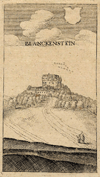 | Blanckenstein
by Mathaüs Meriam | 1650ca | 6 X 10,5 cm | 26 euro
|
|
Gotha:
3 items | Visit our page of the city of Gotha |
Gottingen
 | Die Universitaet in Göttingen
by C. Reiss | 1850ca | 11 X 14 cm | 26 euro
|
|
Greifenstein:
2 items | Visit our page of the city of Greifenstein |
Grieth
 | De Markt te Griet; ´t Huys te Griet
by Paul van Liender, Jan de Beijer | 1758 | 14 X 19,5 cm | 57 euro
|
|
Grieth, Emmerik
 | ´t Huys de Wing en het Steedje Griet; ´t Huys de Wing de Stad Emmerik en den Elterenberg
by Paul van Liender, Jan de Beijer | 1761 | 13 X 18 cm | 52 euro
|
|
Griethausen
 | ´t Dorp Doornik op het Steedje Griet ziende 1732
by Paulus van Liender, naar Jan de Beijer | 1762 | 12,5 X 8,5 cm | 32 euro
|
|
Halberstadt
 | Das Rathhaus in Halberstadt
by NN | 1880ca | 11,5 X 18 cm | 16 euro
|
|
Hamburg:
9 items | Visit our page of the city of Hamburg |
Hannover:
3 items | Visit our page of the city of Hannover |
Hanselaer
 | ´t Dorp Hanseler 1746
by Paulus van Liender, naar Jan de Beijer | 1760 | 13 X 9 cm | sold
|
|
Harz
 | Die Rosstrappe am Harz
by J.G. Martini | 1848 | 16 X 13 cm | 16 euro
|
|
Hassfurt
 | Hassfurt
by Mattheaus Merian | 1650ca | 16,5 X 8 cm | 52 euro
|
|
Haunstetten
 | Vertooning hoedaanig een grote partye Saltzburgers by Hauszstetten
by nn | 1734 | 13,5 X 8,5 cm | 26 euro
|
|
Heckersdorf
 | Schloss Heckersdorf an der Donau
by nn | 1850ca | 15 X 10 cm | 26 euro
|
|
Heidelberg:
17 items | Visit our page of the city of Heidelberg |
Heldburg
 | Die Heldburg Der Strauchhayn
by nn | 1850ca | 15 X 11 cm | 21 euro
|
|
Henneberg
 | Ruine Henneberg
by nn | 1850ca | 15 X 11 cm | 26 euro
|
|
Hildesheim:
2 items | Visit our page of the city of Hildesheim |
Hildgardsberg
 | Ruine Hildgardsberg in Bayern
by nn | 1850ca | 15 X 10 cm | 26 euro
|
|
Hoch-Winzer
 | Hoch-Winzer in Bayern
by nn | 1850ca | 15 X 10 cm | 26 euro
|
|
Hofheim
 | Die Bettenburg
by nn | 1850ca | 11 X 15 cm | 21 euro
|
|
Hohenschwangau
 | Hohenschwangau
by nn | 1850ca | 15 X 11 cm | 32 euro
|
|
Hohenstein:
4 items | Visit our page of the city of Hohenstein |
Hommersum
 | ´t Dorp Hommersum 1746
by Paul van Liender, Jan de Beijer | 1760 | 13,5 X 9 cm | 32 euro
|
|
Hutting
 | Castle of Hueting
by S. Read, Whimper | 1844 | 13 X 9 cm | 21 euro
|
|
Inselsberg
 | Der Inselsberg
by nn | 1850ca | 15 X 11 cm | 21 euro
|
|
Istein
 | Klooster bij Istein
by NN | 1850ca | 15,5 X 11 cm | 26 euro
|
|
Jülich
 | Jonkersdorp
by NN | 1775ca | 16 X 12,5 cm | 26 euro
|
|
Jena
 | Die Leuchtenburg
by W. Wallis, naar Pfranger | 1850ca | 16 X 13 cm | 26 euro
|
|
Kamp-Lintfort
 | ´t Huys Eyll 1746
by Paul van Liender, Jan de Beijer | 1758 | 14 X 9,5 cm | 32 euro
|
|
Kapfelberg
 | Gegend bey Kapfelberg, oberhalb Regenburg, an der Donau
by NN | 1840ca | 16,5 X 12 cm | 32 euro
|
|
Karlsruhe:
3 items | Visit our page of the city of Karlsruhe |
Kassel:
5 items | Visit our page of the city of Kassel |
Katz
 | Katz on the Rhine, from an original drawing by H. Brown
by H. Winkles naar H. Brown | 1835ca | 15 X 14,5 cm | 42 euro
|
|
Kaub:
2 items | Visit our page of the city of Kaub |
Kaufbeuren
 | Gesichte van Kauffbeuren
by nn | 1734 | 13,5 X 8,5 cm | 26 euro
|
|
Keimburg
 | Ruins of Keimburg
by A. Cruse naar Tombleson | 1832 | 15,5 X 11,5 cm | 21 euro
|
|
Kelheim
 | Die Donau bey Kellheim in Bayern
by nn | 1850ca | 15 X 11,5 cm | 21 euro
|
|
Kellen
 | Het dorp Kellen by Cleeff 1745
by Paul van Liender, Jan de Beijer | 1758 | 14 X 9,5 cm | 37 euro
|
|
Kellheim
 | Die Donau bei Kellheim in Bayern
by nn | 1850ca | 15 X 10 cm | 26 euro
|
|
Kervendonk
 | Het Kasteel te Kervendonk 1743
by Paul van Liender, Jan de Beijer | 1761 | 13,5 X 19 cm | 52 euro
|
|
Keulen:
9 items | Visit our page of the city of Keulen |
Keulen, Cologne
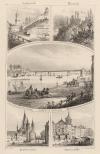 | Andernach, Rheineck, de Rijnbrug voor Keulen, Hoofdkerk te Bonn, Stadhuis te Keulen
by C.C.Last | 1850ca | 11,5 X 18 cm | 32 euro
|
|
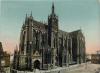
Keulen, Cologne, Köln
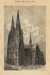 | Dom te Keulen
by Winkler Prins, Brockhaus | 1909 | 14 X 22 cm | 9 euro
|
|
Kevelaer
 | Het Huys Steens aan de Niers
by Paul van Liender, Jan de Beijer | 1761 | 13,5 X 9,5 cm | 32 euro
|
|
Kissingen:
2 items | Visit our page of the city of Kissingen |
Kleef:
10 items | Visit our page of the city of Kleef |
Kleef, Kleve:
2 items | Visit our page of the city of Kleef, Kleve |
Koblenz:
22 items | Visit our page of the city of Koblenz |
Konstanz
 | Constanz und das Panorama der Alpen
by NN | 1850ca | 16 X 13 cm | 32 euro
|
|
Kriebethal
 | Kriebenstein
by NN | 1850 | 10 X 7,5 cm | 16 euro
|
|
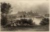
Lübeck
 | Market Place Lübeck
by W. Ratclyffe, naar A.G. Vickers | 1885ca | 14 X 10,5 cm | 32 euro
|
|
Lüneburg
 | Zeldzame donder te Lunenburg
by NN | 1680ca | 15 X 10,5 cm | 47 euro
|
|
Lahnstein
 | Ruine Lahneck
by NN | 1850ca | 15 X 11 cm | sold
|
|
Lauterstein
 | Lauterstein / Sachsen Ruinen des Schlosses Lauterstein
by E. Sommer | 1835ca | 18 X 12,5 cm | 26 euro
|
|
Leipzig:
5 items | Visit our page of the city of Leipzig |
Ludwigsburg
 | Hohenasberg
by NN | 1850ca | 15 X 12 cm | 26 euro
|
|
München (Munich)
 | München
by Winkler Prins | 1910 | 27 X 22 cm | sold
|
|
München, Munich:
9 items | Visit our page of the city of München, Munich |
Mainau
 | Isle of Meinau
by S. Lacey, W. Tombleson | 1840ca | 15,5 X 10 cm | 32 euro
|
|
Mainz:
12 items | Visit our page of the city of Mainz |
Manderscheid
 | Das Lieserthal
by Verlag v. Henry | 1880ca | 24 X 18 cm | sold
|
|
Mannheim:
4 items | Visit our page of the city of Mannheim |
Marburg
 | Marburg
by C. Reiss | 1850ca | 15 X 11 cm | 32 euro
|
|
Mehr
 | Action near Meer, the 5 of August 1758
by nn | 1758 | 19,5 X 11,5 cm | 32 euro
|
|
Meissen
 | Meissen
by H. Bibby, A.H.Payne | 1850ca | 16,5 X 12,5 cm | 42 euro
|
|
Memmingen
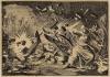 | Tijdens het beleg van Memmingen ontploft een granaat in een woning, vrouw en kinderen blijven onged
by Jan Luyken | 1698 | 15,5 X 12 cm | 47 euro
|
|
Metz
 | Metz Cathedrale
by nn | 1920ca | 24 X 18 cm | sold
|
|
Minden
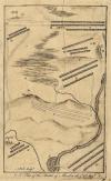 | A plan of the Battle of Minden the 1st of August
by A. Bell | 1790ca | 11,5 X 19 cm | 26 euro
|
|
Moers
 | Beleg en verovering van Meurs
by Pieter Bast | 1615ca | 16,5 X 14 cm | 68 euro
|
|
Moyland
 | ´t Slot Moyland 1746
by Paul van Liender, Jan de Beijer | 1760 | 13,5 X 9 cm | 32 euro
|
|
Muhlberg
 | Burg
by Michael ab Isselt | 1586 | 7 X 6 cm cm | 52 euro
|
|
Mulheim an der Ruhr
 | Soubs Philippe III, gouvernant l´Archiduc Albert & le Prince Maurice
by Willem Baudartius | 1616 | 17 X 14 cm | 63 euro
|
|
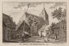
Munster
 | De Lamberti-kerk te Munster
by C.C.A. Last | 1850ca | 17 X 12 cm | 26 euro
|
|
Nassau:
2 items | Visit our page of the city of Nassau |
Naumburg (Saale)
 | Naumburger Dom
by nn | 1850ca | 16,5 X 13 cm | 42 euro
|
|
Neuburg
 | Neuburg
by nn | 1850ca | 14 X 10 cm | 42 euro
|
|
Neuburg an der Donau:
2 items | Visit our page of the city of Neuburg an der Donau |
Neuenhaus
 | Nieuhuijs Bentheimisch
by M. Merian | 1654 | 17,5 X 8 cm | 42 euro
|
|
Neuhaus
 | Neuhaus F.B.L. Ambtshauss
by M. Merian | 1640ca | 17,5 X 9 cm | 37 euro
|
|
Neurenberg
 | Die Burg in Nürnberg
by nn | 1850ca | 10 X 15 cm | 42 euro
|
|
Neurenberg, Nuremberg:
3 items | Visit our page of the city of Neurenberg, Nuremberg |
Neustadt an der Weinstrasse:
2 items | Visit our page of the city of Neustadt an der Weinstrasse |
Nienburg:
2 items | Visit our page of the city of Nienburg |
Nordhorn
 | Northorn
by nn naar Frans Hogenberg | 1616 | 16,5 X 13,5 cm | 63 euro
|
|
Nordlingen
 | Inhaaling der Saltzburgers binnen Nordlingen
by nn | 1734 | 13,5 X 8,5 cm | 26 euro
|
|
Nossen
 | Nossen
by nn | 1850ca | 15 X 11 cm | 21 euro
|
|
Oberhausen
 | Vertooning van het vertrek der Ballingen van Oberhauzsen
by nn | 1734 | 13,5 X 8,5 cm | 26 euro
|
|
Oberwesel:
4 items | Visit our page of the city of Oberwesel |
Orsoy:
2 items | Visit our page of the city of Orsoy |
Ossenbruch
 | ´t Huys Ossenbroek 1746
by Paul van Liender, Jan de Beijer | 1760 | 13,5 X 9,5 cm | 32 euro
|
|
Passau:
4 items | Visit our page of the city of Passau |
Pommern
 | Barbata Quaestio
by Daniel Meisner | 1626ca | 15 X 10 cm | 130 euro
|
|
Qualburg
 | Het dorp Qualburg by Cleeff 1746
by Paul van Liender, Jan de Beijer | 1758 | 14 X 9,5 cm | sold
|
|
Rees:
2 items | Visit our page of the city of Rees |
Regensburg
 | Regensburg
by nn | 1850ca | 15 X 10 cm | 32 euro
|
|
Reichenberg
 | Reichenberg
by M. Merian | 16555 | 7,5 X 11 cm | 32 euro
|
|
Remagen
 | Ansicht von Nonnenwerth, Rolandseck und Drachenfels
by J.A. Lafinsky, R. Bodmer | 1840ca | 15 X 10,5 cm | 42 euro
|
|
Rheinberg:
2 items | Visit our page of the city of Rheinberg |
Rheineck
 | Rheineck
by W. Tombleson, Lacy | 1860ca | 16,5 X 11 cm | 37 euro
|
|
Rheinfels
 | Rheinfels
by Capt. Batty, J.C. Edwards | 1821 | 21 X 13 cm | 37 euro
|
|
Rheinstein
 | Der Rheinstein
by C. Frommel, G.A. Muller | 1840ca | 15,5 X 12 cm | 26 euro
|
|
Rhone
 | Heiliger Kreutzberg und Kloster in der Rhön
by nn | 1850ca | 11 X 14 cm | 21 euro
|
|
Riddagshausen
 | Cistercenser kerk te Riddagshausen bij Brunswijk
by nn | 1879 | 14 X 11 cm | 21 euro
|
|
Riesenburg
 | Die Riesenburg
by nn | 1850ca | 11 X 15 cm | 42 euro
|
|
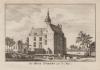
Rijn
 | Kasteel aan de Rijn
by Schelfhout, Jouvenel | 1850ca | 9,5 X 7 cm | 16 euro
|
|
Rodenstein
 | Rodenstein
by nn | 1850ca | 15,5 X 10 cm | sold
|
|
Rothenburg ob der Tauber:
3 items | Visit our page of the city of Rothenburg ob der Tauber |
Rudesheim am Rhein:
2 items | Visit our page of the city of Rudesheim am Rhein |
Rudolstadt
 | Rudolstadt
by nn | 1850ca | 15 X 11 cm | 26 euro
|
|
Ruhrort
 | Rotroort
by Caspar Merian | 1660ca | 18 X 12,5 cm | 26 euro
|
|
Sachsen:
2 items | Visit our page of the city of Sachsen |
Sankt Goar
 | Ruins of Rheinfels
by W. Tombleson, J. Stone | 1840ca | 16 X 12 cm | 26 euro
|
|
Sankt Goarshausen:
3 items | Visit our page of the city of Sankt Goarshausen |
Schandau:
2 items | Visit our page of the city of Schandau |
Schenkenschanz:
4 items | Visit our page of the city of Schenkenschanz |
Schlehdorf
 | Closter Schlehdorff
by Klaus, Ertl | 1690ca | 14,5 X 8 cm | 78 euro
|
|
Schlesien
 | Die Königshütte in Schlesien
by C. Reiss | 1850ca | 15 X 10 cm | 37 euro
|
|
Schmalkalden
 | Schmalkalden
by nn | 1850ca | 15 X 11 cm | 21 euro
|
|
Schnepfenthal
 | Salzmann´s Institut zu Schnepfental
by nn | 1850ca | 15 X 11 cm | 21 euro
|
|
Schwarzburg
 | Schwarzburg
by nn | 1850ca | 15 X 11 cm | 21 euro
|
|
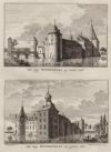
Schwerin
 | Das Grossherzogl. Schloss in Schwerin
by nn | 1850ca | 17 X 12,5 cm | 37 euro
|
|
Sehestedt
 | The village of Schestedt, on the road from Schleswig to Osterade
by nn | 1850ca | 25 X 15,5 cm | 26 euro
|
|
Seitenroda
 | Die Leuchtenburg
by W. Wallis | 1850ca | 17 X 12,5 cm | 21 euro
|
|
Sigmaringen
 | Schloss und Stadt Siegmaringen (Hohensollern)
by nn | 1850ca | 17 X 11,5 cm | 32 euro
|
|
Sinzig
 | Sinzig church
by W. Tombleson | 1840ca | 14 X 12,5 cm | 26 euro
|
|
Speyer
 | Spire
by J.M. Kronheim | 1860ca | 12,5 X 7,5 cm | 26 euro
|
|
Speyer, Spiers:
3 items | Visit our page of the city of Speyer, Spiers |
Stetin
 | Stetin, Aan de Oder en de Domye
by Nicolas de Fer, H. van Loon | 1650ca | 20 X 17.5 cm | 83 euro
|
|
Stralsund
 | Plan of Stralsund with the Trenches, Lines and Batteries
by nn | 1758 | 26 X 20 cm | 57 euro
|
|
Stuttgart:
2 items | Visit our page of the city of Stuttgart |
Tegernsee
 | Tegernsee
by nn | 1850ca | 15 X 11 cm | 32 euro
|
|
Thüringen:
2 items | Visit our page of the city of Thüringen |
Tharand
 | Tharand
by nn | 1850ca | 15 X 11 cm | 16 euro
|
|
Thuringen:
2 items | Visit our page of the city of Thuringen |
Toplitz
 | Toplitz
by nn | 1850ca | 15 X 10 cm | 32 euro
|
|
Traben-Trarbach
 | Plan de la ville et chateau de Traarbach
by Pieter Schenk | 1710 | 19,5 X 17 cm | 52 euro
|
|
Trechtingshausen
 | Burg Rheinstein
by nn | 1920ca | 24 X 18 cm | 26 euro
|
|
Trendelburg
 | Trendelburg
by M. Merian | 1646 | 9 X 11 cm | 63 euro
|
|
Triberg
 | Tryberger Falle
by A.H. Payne | 1840ca | 11 X 18 cm | 37 euro
|
|
Ulm:
2 items | Visit our page of the city of Ulm |
Ulrichstein
 | Ulrichstein
by M. Merian | 1650ca | 9 X 11 cm | 32 euro
|
|
Veste Stolpen
 | Veste Stolpen
by nn | 1850ca | 15 X 11 cm | 21 euro
|
|
Würzburg
 | Würzburg
by nn | 1850ca | 10 X 15 cm | 42 euro
|
|
Wackerstein
 | Wackerstein an der Donau
by nn | 1850ca | 16,5 X 13 cm | 26 euro
|
|
Waldkappel
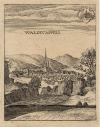 | Waldtcappell
by M. Merian | 1646 | 9 X 11 cm | 37 euro
|
|
Wallhausen
 | Aves con colores facillim� congregantur
by nn | 1650ca | 14,5 X 10 cm | 52 euro
|
|
Wartburg
 | Die Wartburg von der Nordwestseite
by nn | 1850ca | 15 X 11 cm | 26 euro
|
|
Weilheim
 | Castle of Welheim
by Whimper | 1844 | 13 X 9 cm | 26 euro
|
|
Weimar
 | Göthe´s Gartenhaus in Weimar
by nn | 1850ca | 15 X 11 cm | sold
|
|
Wernigerode:
3 items | Visit our page of the city of Wernigerode |
Wesel:
4 items | Visit our page of the city of Wesel |
Wiesbaden:
9 items | Visit our page of the city of Wiesbaden |
Wildenburg
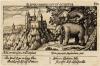 | Elephas magnus est et occiditur - Willenberg
by Daniel Meisner | 1638ca | 15 X 10 cm | 104 euro
|
|
Winnekendonk
 | Het Dorp Wenekendonk 1739
by Paul van Liender, Jan de Beijer | 1761 | 13,5 X 9 cm | 32 euro
|
|
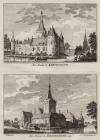
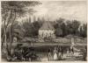
Winnenthal
 | Het Huys Winnendaal by Santen, Het Huys Winnendaal van agteren 1746
by Paul van Liender, Jan de Beijer | 1759 | 13,5 X 19 cm | 52 euro
|
|
Wissen
 | Het Huys Wissen aan de Niers, Het Huys Wissen 1743
by Paul van Liender, Jan de Beijer | 1761 | 14 X 19 cm | 63 euro
|
|
Worms:
9 items | Visit our page of the city of Worms |
Zerbst
 | Das Schloss in Zerbst
by J. Pozzi, A. Fesca | 1850ca | 18 X 13 cm | 26 euro
|
|
Ziegenberg
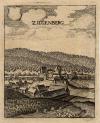 | Ziegenberg
by M. Merian | 1655 | 9 X 11 cm | 63 euro
|
|
Zierenberg:
3 items | Visit our page of the city of Zierenberg |
Zwarte Woud (Schwarzwald):
3 items | Visit our page of the city of Zwarte Woud (Schwarzwald) |
Zwickau
 | Zwickau
by B. Metzeroth | 1850ca | 17,5 X 12 cm | 32 euro
|
|


 follow us on facebook