Rediscover your world at Atlas and Map
The place for your antique maps, plans, books and prints
Recently added maps, plans, views and prints


HOME - MAPS - PRINTS - BOOKS - INFO
Recently added maps, plans, views and prints
Title/MakerYearJaarMeasurePrice
thmbnail of Wittevrouwe-kerk tot UtrechtWittevrouwe-kerk tot Utrecht
by A. Rademaker
1725ca11 X 8 cm37 euro
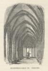
thmbnail of Int. St. Pieter-Pant binnen UtrechtInt. St. Pieter-Pant binnen Utrecht
by A. Rademaker
1720ca11 X 8 cm37 euro
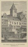
thmbnail of Bylhouders-Toren tot UtrechtBylhouders-Toren tot Utrecht
by A. Rademaker
1720ca11 X 8 cm37 euro
thmbnail of Wittevrouwe-Poort tot UtrechtWittevrouwe-Poort tot Utrecht
by A. Rademaker
1725ca11 X 8 cm37 euro
thmbnail of Agter St. Maria tot UtrechtAgter St. Maria tot Utrecht
by A. Rademaker
1725ca11 X 8 cm37 euro
thmbnail of St. Agnite te UtrechtSt. Agnite te Utrecht
by A. Rademaker
173011,5 X 7,5 cm32 euro
thmbnail of De Marienplaats te Utrecht, de Lutherschen kerk te UtrechtDe Marienplaats te Utrecht, de Lutherschen kerk te Utrecht
by K.F. Bendorp, J. Bulthuis
178911 X 16,5 cm47 euro
thmbnail of Het Verlaten van UtrechtHet Verlaten van Utrecht
by R. Vinkeles naar J. Buys
1790ca9 X 16 cm32 euro
thmbnail of De Kolom in de St. Maria kerk te Utrecht op ossen huiden gevestigdDe Kolom in de St. Maria kerk te Utrecht op ossen huiden gevestigd
by C. Ostermann
184312 X 8 cm26 euro
thmbnail of Pellus-Poort by Utrecht aan de Voorstadt (sic)Pellus-Poort by Utrecht aan de Voorstadt (sic)
by A. Rademaker
1725ca11,5 X 8 cm42 euro
thmbnail of Het Bisschopshof te Utrecht (in het begin der 17e eeuw)Het Bisschopshof te Utrecht (in het begin der 17e eeuw)
by E. Vermorcken, J.H. Koster
1880ca17 X 12,5 cm42 euro
thmbnail of Het VreeburgHet Vreeburg
by nn
1880ca17,5 X 13 cm32 euro
thmbnail of Jaarmarkt te Utrecht in  1120Jaarmarkt te Utrecht in 1120
by C.L. van Kesteren naar Ch. Rochussen
1870ca18,5 X 11 cm32 euro
thmbnail of Sint Mariakerk in UtrechtSint Mariakerk in Utrecht
by H. Sluyter naar Jan Weissenbruch
1870ca17,5 X 13,5 cm47 euro
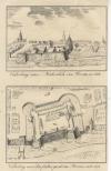
thmbnail of Plompe-Toren tot Utrecht 1672; Bylhouders-Toren tot Utrecht 1660Plompe-Toren tot Utrecht 1672; Bylhouders-Toren tot Utrecht 1660
by A. Rademaker
1730ca11,5 X 16 cm63 euro
thmbnail of Int St. Pieter-Pant binnen Utrecht. 1660Int St. Pieter-Pant binnen Utrecht. 1660
by A. Rademaker
1725ca11,5 X 8 cm37 euro
thmbnail of Vermakelyk gezicht van een gedeelte der Stads WallenVermakelyk gezicht van een gedeelte der Stads Wallen
by J.M. Bregmagher, naar A. Rademaker
172611,5 X 8 cm42 euro
thmbnail of De Binnenhof van het voormalige Kapittelhuis nevens de Domkerk (1870)De Binnenhof van het voormalige Kapittelhuis nevens de Domkerk (1870)
by C. Hechler
187115 X 22 cm37 euro
thmbnail of Bij St. Agnite tot UtrechtBij St. Agnite tot Utrecht
by A. Rademaker
1720ca11 X 8 cm42 euro
thmbnail of Pellus-Poort bij UtrechtPellus-Poort bij Utrecht
by A. Rademaker
1720ca11 X 8 cm42 euro


HOME - MAPS - PRINTS - BOOKS - INFO
New:
Maps
Groningae et Omlandiae Dominium vulgo De Provincie van Stadt en Lande

Kuyper maps
Gemeente Willige -Langerak

Prints
Paus Adriaan de VI

Townplans and views
Enkhuizen: Die Stadt Enchuijsen

Books and atlasses
FACSIMILE: Gemeente-Atlas van Nederland deel 8 Overijssel

We are on facebook now:
follow us on facebook
for news, highlighted special items and items on your dutch roots.


sitemap | recent added | inspired by: kruisbestuiving: benut kennis optimaal - www.kuisbestuiving.nl | contact | RSS | | privacy