|
last update: Jun-01-2026
Maps of Belgium on atlasandmap.com |
| Title/Maker | Year | Measures | Price | |
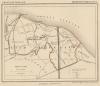
|  | Rochefort, Eprave, Han sur-Lesse, Auffe, Belvaux, Thioré
by nn | 1905 | 10,5 X 16 cm | 11 euro | |  | België en Luxemburg
by Winkler Prins | 1906 | 27 X 22 cm | 16 euro | |  | Carte du Departement de Luxembourg
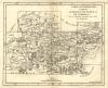
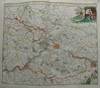
by M. Robert | 1748 | 21,5 X 16,5 cm | 21 euro | |  | Carte du brabant ou se trouvet les Marrs. d Herentals, de Turnhout..
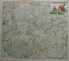
by M. Robert | 1748 | 20 X 16,5 cm | 21 euro | |  | Nederland, Belgie, Luxemburg
by Kuyper (Kuijper) | 1880 | 10 X 15 cm | 26 euro | |  | Duitschland in ´t jaar 1512; De 10 kreitsen naar de verdeeling van keizer Maximiliaan 1, 1512
by P.W.M. Trap | 1876 | 28 X 22 cm | 32 euro | |  | Belgie en Luxemburg, Zwitserland
by F. Bruins | 1884 | 22 X 28 cm | 32 euro | |  | Comte de Haynaut
by nn | 1700ca | 55 X 41 cm | 32 euro | |  | Gaule Independante er Romaine
by Desbuisson, A.T. Chartier | 1881 | 37 X 31 cm | 37 euro | |  | Carte de Belgique et de Hollande
by Thierry | 1843 | 22 X 30 cm | 42 euro | |  | Duche de Luxembourg
by nn | 1750ca | 23 X 15 cm | 47 euro | |  | Mons, comme il est au jour d´huy.
by Nicolas de Fer | 1696 | 29 X 23 cm | 73 euro | |  | Departement de Sambre et Meuse
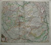
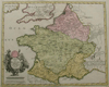
by P.G. Chanlaire, P. Tardieu | 1800ca | 57 X 48 cm | 83 euro | |  | Comitatuum Hannoniae et Namurci Descriptio
by J. Janssonius | 1647 | 59 X 48 cm | 151 euro | |  | Flandria maximus et pulcherrimus
by Matthias Seutter | 1744 | 26 X 20.5 cm | 176 euro | |  | Belgii
by Matthias Seutter | 1740 | 25 X 19 cm | 176 euro | |  | Belgii Regii Accuratissima Tabula Pluribus Locis Recens
by Frederik de Wit | 1670 | 54 X 47 cm | 187 euro | |  | carta nuova ed Accurata delle XVII Provincie de Paesi Bassi
by Isaac Tirion, G Albrizzi | 1735ca | 28 X 33.5 cm | 187 euro | |  | Comte de Namur, Tire des Memoires les pl. nouveaux
by N. Sanson, H. Jaillot | 1674 | 57 X 44 cm | 207 euro | |  | Secunda pars Brabantiae cuius urbs primaria Bruxellae
by J. Janssonius Waesberge, M. Pitt, S. Swart | 1680ca | 53 X 42 cm | 259 euro | |  | Les XVII Provinces des Pais Bas
by Le Dauphin, VC, van Loon | 1705 | 21 X 27 cm | 280 euro | |  | Belgii veteris typus Ex Conatibus Geographicis Abrahami Ortelii
by Petrus Kaerius | 1741 | 49 X 38 cm | 311 euro | |  | Cercle de Bourogne
by Mallet | 1730ca | 10 X 15 cm | sold | |  | REPRODUCTION: Flandia comit
by Gerard Mercator | 1585 | 40 X 28 cm | sold | |  | Niederlande und Belgien
by Richard Andree | 1896 | 38 X 53 cm | sold | |  | Hollande et Belgique
by Monin | 1842 | 20 X 26 cm | sold | |  | Holland and Belgium
by Hall | 1839 | 20 X 24 cm | sold | |  | Niederlande und Belgien
by Justus Perthes | 1861 | 18 X 23 cm | sold | |  | Holland and Belgium
by F.P. Becker, Virtue | 1848 | 20 X 25 cm | sold | |  | Pays-Bas et Belgique
by Dufour | 1840 | 20 X 26 cm | sold | |  | de Nederlanden, Luxemburg en België
by A. Baedeker | 1844 | 25,5 X 21 cm | sold | |  | Duitschland onder de saksiche en frankische Keizers tot 1138
by P.W.M. Trap | 1876 | 28 X 22 cm | sold | |  | Pays Bas Catholiques
by Robert de Vaugondy | 1784 | 15 X 15 cm | sold | |  | Holland and Belgium
by Kelly | 1834 | 20 X 25 cm | sold | |  | Netherlands now divided into Holland and Belgium
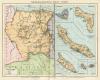
by A Black, C Black | 1844 | 26 X 38 cm | sold | |  | Nederland, Belgie en Luxemburg
by P.W.M. Trap | 1872 | 23 X 28,5 cm | sold | |  | Belgique et Hollande
by Lemercier | 1860ca | 35 X 43 cm | sold | |  | Ducatus Lutzenburgici Tabula Nuperrime In Lucem Edita Per Fredericum De Wit.
by Frederik de Wit | 1670 | 56 X 46 cm | sold | |  | Holland and Belgium
by G.H. Swanston | 1850 ca | 40 X 50 CM cm | sold | |  | Belgium and the Netherlands
by Keith Johnston | 1850 ca | 44 X 56 CM cm | sold | |  | Hollande et Belgique par C.V. Monin
by C.V. Monin, Hocquart, :aguillermie | 1839 | 28 X 40 cm | sold | |  | Germanie Inferieure - Les Dixsept Provinces - Pays Bas
by Jan van Vianen? | 1715ca | 16.5 X 14.5 cm | sold | |  | Blinde kaart
by nn | 1740ca | 28 X 24 cm | sold | |  | Gallia Belgica
by Abraham Ortelius | 1601 | 11,5 X 9,5 cm | sold | |  | Le XVII provinces del Paesi Bassi
by nn | 1700ca | 18 X 14.5 cm | sold | |  | Carta noua accurata del Passagio et strada dalli Paesi Bassi per via Allemagna per Italia et per via
by Frederik de Wit | 1670 | 56 X 47 cm | sold | | ") | Belgii veteris typus (ingelijst)
by Petrus Kaerius | 1700 | 47.5 bij 38 cm | sold | |
Maps of regions in Belgium on atlasandmap.com |
| Region | Title/Maker | Year | Measures | Price | |
|
 | Dioecesis Leodiensis accurata tabula
by Frederik de Wit | 1670 | 55 X 46 cm | 187 euro
| |
 | Tabula Comitatus Artesiae emendata
by Frederik de Wit | 1670 | 56 X 46 cm | 166 euro
| |
 | Carte du Brabant ou sont les Mairies de Roo, de Nivelle, de Hulpen, et de Geneppe
by M. Robert | 1748 | 20 X 17 cm | 21 euro
| |
 | Carte du comte du Haynaut
by M. Robert | 1748 | 16 X 17 cm | 21 euro
| |
 | Carte du Duche de Luxembourg
by M. Robert | 1748 | 20 X 17,5 cm | 21 euro
| |
 | Carte du Comte de Haynaut
by M. Robert | 1748 | 16 X 17 cm | 21 euro
| |
 | Carte du Departement de Luxembourg
by M. Robert | 1748 | 20,5 X 16,5 cm | 21 euro
| |
 | Carte du Departement de Luxembourg
by M. Robert | 1748 | 21 X 16,5 cm | 21 euro
| |
 | Carte Generale des Comtes de Haynaut, de Namur et de Cambresis
by M. Robert | 1748 | 20,5 X 17 cm | 21 euro
| |
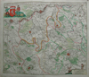
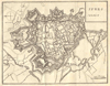
 | Tabula ducatus Brabantiae continens marchionatum et dominium Mechliniense
by Frederik de Wit | 1670 | 55 X 47 cm | sold
| |
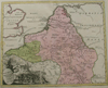
 | Tabula Ducatis Limburch Et Comitatus Valckenburgh in Lucem. Edita A.F. De Wit.
by Frederik de Wit | 1670 | 56 X 47 cm | sold
| | Netherlands
 | Gallia Belgica
by Weigel, Christoph (Witwe) | 1720 | 38 X 31 cm | sold
| |
 | Comitatus Namurci tabula in lucem
by Frederik de Wit | 1670 | 55 X 46 cm | sold
| |
 | Comitatus Hannoniae et Episcopatus Cambresis Descriptio
by Frederik de Wit | 1670 | 55 X 46 cm | sold
| |
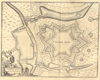
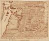
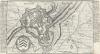
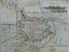
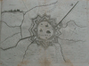
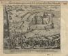
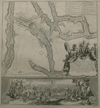 | Plan de la situation ou la bataille de Ramillis
by Scheurtje linksboven in marge | 1706 | 43 X 46.5 cm | sold
| | Belgium
 | Gallia
by Weigel, Christoph (Witwe) | 1720 | 38 X 31 cm | sold
| |
Plans of cities in Belgium on atlasandmap.com |
| Town | Title/Maker | Year | Measures | Price | |
| Antwerpen:
23 items | Visit our page of the city of Antwerpen | Antwerpen, Antwerp:
2 items | Visit our page of the city of Antwerpen, Antwerp | Arras:
2 items | Visit our page of the city of Arras | Beaumont/Henegouwen
 | Beaumontin huinaut
by Lodovico Guicciardini | 1612 | 18 X 13,5 cm | 47 euro
| | Beersel
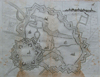
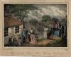
 | Chateau de Beersel, province de Brabant
by nn | 1850ca | 15 X 10 cm | 32 euro
| | Bergen:
3 items | Visit our page of the city of Bergen | Bergen, Mons:
2 items | Visit our page of the city of Bergen, Mons | Beveren
 | Castellum Bevernae, Vulgo, Beveren
by Henri (Hendrik) Causé | 1696 | 20,5 X 11,5 cm | 21 euro
| | Borgerhout
 | Slag bij Burgerhout
by J.F.C. Reckleben | 1868 | 19 X 15 cm | sold
| | Bouillon:
2 items | Visit our page of the city of Bouillon | Bourbourg
 | Fort de Linck
by Jacob van der Schley | 1667 | 16 X 11,5 cm | 52 euro
| | Brugge:
14 items | Visit our page of the city of Brugge | Brugge, Bruges:
4 items | Visit our page of the city of Brugge, Bruges | Brussel:
23 items | Visit our page of the city of Brussel | Brussel, Brussels
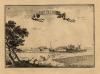
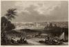
 | Brussel
by Captain R. Batty, W. Woolnoth | 1824 | 14 X 20 cm | 156 euro
| | Brussel, Houyet
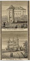 | La Porte de Halle (a Bruxelles), Le Chateau de Celles
by 1850ca | 1850ca | 13,5 X 7 cm | 16 euro
| | Brussel, Laken
 | Palais du roi, a Laeken
by nn | 1850ca | 13 X 9 cm | 16 euro
| | Charleroi
 | Charle Roy
by J. Harrewijn | 1720ca | 18 X 14 cm | 73 euro
| | Chimay:
2 items | Visit our page of the city of Chimay | Choquier
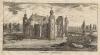
 | Castle of Choquier
by B. Winkles, naar Salmon | 1835ca | 14,5 X 10,5 cm | 21 euro
| | Cour-Saint-Etienne
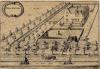
 | Castellum Curtis S. Stephani
by Jacob Harrewijn | 1700ca | 22 X 12,5 cm | 83 euro
| | Dinant:
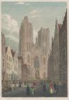
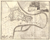
2 items | Visit our page of the city of Dinant | Doornik
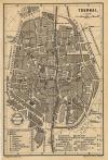 | Tournai
by nn | 1900ca | 10 X 16 cm | 11 euro
| | Doornik, Tournai:
2 items | Visit our page of the city of Doornik, Tournai | Ekeren, Wilmarsdonk
 | De roemruchtige verwinninge van de Geallieerde de Franssen uyt het veld slaande tusschen Eekeren en
by Pieter Schenk | 1705ca | 19,5 X 16,5 cm | 63 euro
| | Evergem
 | Hellewege
by nn | 1650ca | 23,5 X 16 cm | 42 euro
| | Fleurus
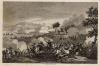 | Bataille de Fleurus
by Couché | 1820ca | 13,5 X 10 cm | 21 euro
| | Gent:
13 items | Visit our page of the city of Gent | Gent, Gand:
2 items | Visit our page of the city of Gent, Gand | Gent, Gand, Ghent
 | La Ville de Gand; De stad Gend
by J. Harrewijn | 1700ca | 18 X 14 cm | 73 euro
| | Gent, Ghent:
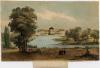
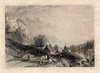
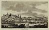
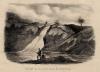
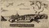
16 items | Visit our page of the city of Gent, Ghent | Hoei
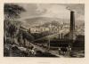
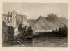 | Huy - river Meuse
by A.H. Payne, naar W.H. Bartlett | 1840ca | 15,5 X 11,5 cm | 21 euro
| | Ipres, Iperen, Yperen, Ypres:
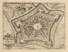
2 items | Visit our page of the city of Ipres, Iperen, Yperen, Ypres | Kortrijk
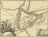
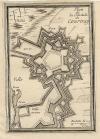 | Plan de la citadelle de Courtray
by S. de Pontault de Beaulieu | 1665 | 10 X 14 cm | sold
| | Leuven:
2 items | Visit our page of the city of Leuven | Leuven, Mechelen
 | Leuven, Mechelen
by Sebastian Munster | 1574 | 18 X 30 cm | 114 euro
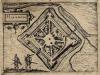
| | Liefkenshoek
 | De Schans Liefkenshoek
by C.F. Bendorp | 1792 | 10,5 X 9,5 cm | 42 euro
| | Lille, Rijsel
 | Lilla
by Priorato, Galeazzo Gualdo | 17th-1 | 40 X 31 cm cm | sold
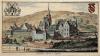
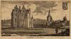
| | Limbourg
 | Limbourg
by J. Harrewijn | 1720ca | 18 X 14 cm | 52 euro
| | Limburg, Limbourg
 | Limbourg, dépt de L´Ourthe
by nn | 1700ca | 16,5 X 10,5 cm | 47 euro
| | Loenhout
 | Kasteel van Loenhout, Castellum de Loenhout
by nn | 1757 | 21 X 11,5 cm | 37 euro
| | Luik:
4 items | Visit our page of the city of Luik | Luik of Liege
 | Lüttich in Belgien
by C. Reiss | 1850ca | 15 X 10 cm | 42 euro
| | Luik, Liege:
6 items | Visit our page of the city of Luik, Liege | Luxemburg
 | Gezigt in de provincie Luxemburg
by nn | 1860ca | 12 X 9 cm | 26 euro
| | Mariembourg
 | Mariebourg
by Lodovico Guicciardini | 1612 | 17 X 13 cm | sold
| | Mechelen:
9 items | Visit our page of the city of Mechelen | Menen
 | Menen oder Menin
by Gabriel Bodenehr | 1725ca | 31 X 17 cm | sold
| | Mont-Saint-Jean
 | Monument du Major Arthur Rowley Heyland
by H. Gerard | 1840ca | 19 X 15,5 cm | sold
| | Namen:
9 items | Visit our page of the city of Namen | Namen, Namur:
8 items | Visit our page of the city of Namen, Namur | Nieuwpoort:
2 items | Visit our page of the city of Nieuwpoort | Nieuwpoort, Nieuport
 | Neiuport
by Priorato, Galeazzo Gualdo | 17th-18th | 40 X 31 cm cm | sold
| | Oostende
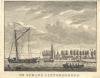
 | Oostende
by nn | 1650ca | 20 X 12 cm | 47 euro
| | Oudenaarde:
5 items | Visit our page of the city of Oudenaarde | Philippeville
 | Philippeville
by Lodovico Guicciardini | 1648 | 18 X 14 cm | 52 euro
| | Plancenoit
 | Das den gefallenen Preussen errichtete eiserne Monument zu Plancenois
by nn | 1830ca | 16 X 10 cm | 16 euro
| | Poilvache:
2 items | Visit our page of the city of Poilvache | Quatre-Bras
 | Quatre Bras
by nn | 1830ca | 15 X 10 cm | 16 euro
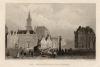
| | Sint Omaars, St Omer
 | L´Eglise cathedrale de s´Omer; De cathedrale kerk van St Omer
by J. Harrewijn | 1700ca | 18 X 14 cm | 32 euro
| | Spa:
4 items | Visit our page of the city of Spa | St Omer:
2 items | Visit our page of the city of St Omer | St Vaast
 | L´Abbaie Roiale de St Vaast. De Koninglijke Abdeye van St Vaast
by J. Harrewijn | 1700ca | 18 X 14 cm | 32 euro
| | Temse
 | Gezigt van het vrouwenhof te Temsche tot in het jaar 1772
by F. Kierdorff, naar Rommel | 1800ca | 14 X 9,5 cm | 26 euro
| | Termonde, Dendermonde
 | Termunda
by Priorato, Galeazzo Gualdo | 17th-18th | 40 X 31 cm cm | 63 euro
| | Terwaan, Therouanne:
2 items | Visit our page of the city of Terwaan, Therouanne | Tienen
 | Tienen
by L. Guicciardini | 1610ca | 23 X 16,5 cm | 83 euro
| | Tournay, Doornik
 | Tournay
by Priorato, Galeazzo Gualdo | 17th-18th | 40 X 31 cm cm | 63 euro
| | Verviers
 | Verviers
by H. Bond, naar J. Fussell | 1840ca | 15,5 X 11 cm | 21 euro
| | Veurne
 | Der Marktplatz zu Furnes
by nn | 1840ca | 15,5 X 11 cm | 21 euro
| | Veurne, Furnes
 | Furnes
by Priorato, Galeazzo Gualdo | 17th-18th | 40 X 31 cm cm | 63 euro
| | Vorsselaer
 | Castellem Vorsselaer
by Franz Ertinger | 1706 | 21,5 X 12 cm | 52 euro
| | Westerlo
 | Westerlo: Sous Philippe 2, gouvernant le Pr. de Parme & le Duc d´Alencon
by Willem Baudartius | 1616 | 16 X 14 cm | 57 euro
| | Westkapelle:
2 items | Visit our page of the city of Westkapelle | Ypres, Yperen
 | Jpres, Jperen
by Harrewijn? | 1720ca | 18 X 14 cm | sold
| |
| |


 follow us on facebook