Rediscover your world at Atlas and Map
The place for your antique maps, plans, books and prints
Antique maps of Denmark
Only orginal maps an prints
On atlasandmap.com you can find
only original
items for sale
You will get a certificate of authenticity with each map or print:
HOME
-
MAPS
-
PRINTS
-
BOOKS
-
INFO
Antique maps of Denmark
last update: Nov-09-2020
Maps of Denmark on atlasandmap.com
Title/Maker
Year
Measures
Price
Denemarken
by Kuyper (Kuijper)
1880
15 X 10 cm
19 euro
Denemarkern en Zuid-Zweden
by Winkler Prins
1907
29 X 22 cm
21 euro
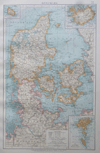
Dänemark
by Richard Andree
1896
23 X 38 cm
23 euro
Skandinavie of Zweden en Noorwegen; Denemarken en IJsland
by F. Bruins
1884
28 X 22 cm
37 euro
Noord-Duitschland en Denemarken
by P.W.M. Trap
1872
28,5 X 23 cm
42 euro
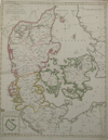
Norwege Suede et Danemark
by Félix Delamarche
1833
28 X 26 cm cm
52 euro
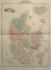
Danemark, Islande et Iles Faeröe
by Migeon, Sengteller, Desbuissons
1881
28 X 40 cm
63 euro
Nieuwe kaart van Denemarken Volgens de laatste bepaling van 9 Sept 1806
by Francois Bohn
1807
37.5 X 47 cm
83 euro
Le Royaume de Danemark
by de Missy, de Leth
1749
22 X 16 cm
99 euro
Tabula germaniae emendata recens per Nicolaum Joh. Piscatorem.
by Nicolaas Visscher - Frederik de Wit
1670
55 X 47 cm
187 euro
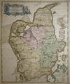
Regni Daniae
by N. Visscher
1696
55 X 45 cm
228 euro
Scandinavia complectens Sueciae, Daniae , Norvegia Regna
by Johann Baptiste Homann
1720
55 X 47.5 cm
228 euro
Regni Daniae Accuratissima Delineatio.
by Frederik de Wit
1670
55 X 45 cm
228 euro
Insulae Danicae in Mare Baltico Sitae
by Ioh. Barth Homann
1720
58 X 49 cm
228 euro
Royaume de Danemark
by Robert Vaugondy
1760
57 X 49 cm
228 euro
REPRODUCTION: Ducatus Sleswici pars Borealis
by Joan Mejerus
1662
60.5 X 41.5 cm
sold
Denemarken en IJsland
by A. Baedeker, Rotterdam
1844
27,5 X 21,4 cm
sold
De noordelijke kustlanden van Duitschland van Emden tot nabij Straalsond
by nn
1870
40 X 32 cm
sold
Carte du Royaume de Danemark
by Guillaume de l´isle
1742
48 X 60 cm
sold
Nieuwe kaart van het Koninkrijk van Deenemarken
by Isaac Tirion
1743
34 X 28 cm
sold
Maps of regions in Denmark on atlasandmap.com
Region
Title/Maker
Year
Measures
Price
Lutiae
by Frederik de Wit
1680ca
48 X 58 cm
435 euro
Nova et accurata descriptio totius Fioniae vulgo Funen
by Joh Janssonius
1652
51 X 40 cm
176 euro
REPRODUCTION: Nieuwe pascaert van de Sond en de Beldt
by Joannes van Keulen
1649
57 X 50 cm
sold
Plans of cities in Denmark on atlasandmap.com
Town
Title/Maker
Year
Measures
Price
Amager
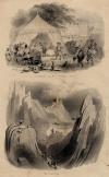
Gastmaal op het Eiland Amak. De Landing.
by A.L.
1844
13 X 22 cm
26 euro
Fehmarn, Lolland
Zee Battaille voor gevallen op den 24 Apr. 1715
by Peter Schenk
1725ca
19 X 16 cm
sold
Frederiksberg
Frederiksberg Slot - Château de Frederiksberg
by Ja. Gray
1850ca
15 X 11 cm
32 euro
Kopenhagen:
3 items
Visit our page of the city of Kopenhagen
Kopenhagen, Helsingor
Galjoenen bij de kust van slot Kronborg
by nn
1700ca
18,5 X 13,5 cm
sold
Kronburg, Helsingor
Schloss Kronburg
by C. Reiss
1850ca
15 X 11 cm
32 euro
Nyborg
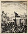
Zeeslag bij slot Nyborg
by nn
1725ca
13 X 16 cm
sold
Roskilde
Der Roeskilde Cathedrale
by C. Reiss
1850ca
15 X 11 cm
32 euro
Sont, Oresund, The Sound
Der Sund
by nn
1850ca
17 X 11,5 cm
26 euro
Vallo
Vallöe Kloster - Le Couvent de Vallöe
by C.F. Christensen, J. Gray
1850ca
15 X 14 cm
21 euro
HOME
-
MAPS
-
PRINTS
-
BOOKS
-
INFO
New:
Maps
Sud-Westliches Deutschland und die Schweiz
Kuyper maps
Gemeente Gouda
Prints
Reinoud IIe agttiende heer van Brederode, door de Utrechtsche Bisschop, David van Bourgondien...
Townplans and views
Utrecht: La Ville d´Utrecht
Books and atlasses
FACSIMILE: Gemeente-Atlas van de provincie Friesland 1861
We are on facebook now:
follow us on facebook
for news, highlighted special items and items on your dutch roots.
sitemap
|
recent added
|
inspired by:
|
contact
|
RSS
|
|
privacy