|
last update: Nov-06-2020
Maps of Italy on atlasandmap.com |
| Title/Maker | Year | Measures | Price | |
|  | Napels en Omstreken
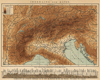
by Winkler Prins | 1910 | 22 X 14 cm | 11 euro | |  | Karintië, Krain, Salzburg, Stiermarken, Tirol en Vorarlberg
by Winkler Prins | 1909 | 28 X 22 cm | 16 euro | |  | Rome en Omstreken
by Winkler Prins | 1910 | 27 X 22 cm | 16 euro | |  | Kaart Italien eller Apenninska Halfön.
by Stieler | 1868 | 26,5 X 21 cm | 21 euro | |  | Italië, Zuidelijk Gallië, Hispanië en Africa, bijzonder voor den tijd der Punische oorlogen
by De Erven Thierry en Mensing | 1858 | 31,5 X 22 cm | 21 euro | |  | Gallië en Germanië voornamelijk in de 2e eeuw n. Chr.
by De Erven Thierry en Mensing | 1858 | 31,5 X 22 cm | 21 euro | |  | Opper- en Middel - Italië
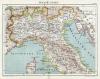
by Winkler Prins | 1908 | 28 X 22 cm | 21 euro | |  | Oud - Italië
by Winkler Prins | 1908 | 22 X 28 cm | 23 euro | |  | Mittelitalien
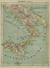
by Richard Andree | 1896 | 49 X 38 cm | 23 euro | |  | Beneden - Italië
by Winkler Prins | 1908 | 28 X 22 cm | 26 euro | | ") | Ancient Africa or Libya part 1 (incl. Sardinia, Baleares)
by J en C Walker | 1840 | 40 X 31 cm cm | 32 euro | |  | Italië ten tijde der Romeinse Republiek; ten tijde van den aanvang der Romeinsche Republiek 509 v.C
by De Erven Thierry en Mensing | 1858 | 31,5 X 22 cm | 32 euro | |  | Het Romeinsche Rijk ten tijde van zijnen grootsten omvang
by De Erven Thierry en Mensing | 1858 | 31,5 X 22 cm | 32 euro | |  | Griekenland en zijne volkplantingen; Italie omstreeks 500
by P.W.M. Trap | 1876 | 28 X 22 cm | 32 euro | |  | Oud-Italie; Latium; Campania
by P.W.M. Trap | 1876 | 28 X 22 cm | 32 euro | |  | Zuid-Europa en Voor-Azie ten tijde van de Kruistochten; Koningrijk Jeruzalem
by P.W.M. Trap | 1876 | 28 X 22 cm | 32 euro | |  | Zwitserland voor de Fransche omwenteling; in 1866; Italie omstreeks 1500; omstreeks 1792
by P.W.M. Trap | 1876 | 28 X 22 cm | 32 euro | |  | Het Balkan-Schiereiland
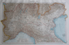
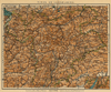
by F. Bruins | 1884 | 22 X 28 cm | 37 euro | |  | Italië
by H.A. Tjeenk Willink | 1860ca | 21,5 X 26 cm | 37 euro | |  | Italie Septentrionale, Divisee en ses diferens Etats
by Félix Delamarche | 1833 | 40 X 26 cm cm | 42 euro | |  | Italië
by A. Baedeker, Rotterdam | 1844 | 26,5 X 21 cm | 42 euro | |  | Italie Septentrionale
by Migeon, Sengteller, Desbuissons | 1881 | 37 X 30 cm | 42 euro | |  | Italie Méridionale
by Migeon, Sengteller, Desbuissons | 1881 | 28 X 40 cm | 42 euro | |  | Italie
by P.W.M. Trap | 1872 | 23 X 28,5 cm | 42 euro | |  | Italie
by F. Bruins | 1884 | 22 X 28 cm | 42 euro | |  | Royaume des Deux-Siciles Sardaigne
by Félix Delamarche | 1832 | 37 X 26 cm cm | 52 euro | |  | Italië en de Illyrische Provinciën ten tijde van Napoleon I
by De Erven Thierry en Mensing | 1858 | 31,5 X 22 cm | 52 euro | |  | Dominii Veneti in Italia
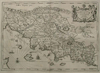
by Frederick de Wit | 1685ca | 62 X 50 cm | 414 euro | |  | Illustrissimo celsissimoque principi Carolo Emanueli D. G. Sabaudiae Duci, Pedemontii principi
by Frederick de Wit | 1680ca | 48 X 57 cm | 466 euro | |  | Frankrijk 1360 - 1610, Italie 1300 - 1600
by De Erven Thierry en Mensing | 1858 | 31,5 X 22 cm | sold | |  | übersichtskarte von Italien
by Richard Andree | 1896 | 37 X 49 cm | sold | |  | Italie Ancienne
by Debuissons, A.T. Chartier | 1881 | 28 X 37 cm | sold | |  | Alpenkaart
by F. Bruins | 1884 | 28 X 22 cm | sold | |  | Italiae Antiquae
by Félix Delamarche | 1832 | 33 X 29 cm cm | sold | |  namtellus Gracia maior") | Itala (Italia) namtellus Gracia maior
by Joannes Jansonius | 1750ca | 52 X 38 cm | sold | |  | Italie
by Migeon, Sengteller, Desbuissons | 1881 | 30 X 40 cm | sold | |  | Carta noua accurata del Passagio et strada dalli Paesi Bassi per via Allemagna per Italia et per via
by Frederik de Wit | 1670 | 56 X 47 cm | sold | |  | Tabula Italiae Corsicae, Sardiniae, et adjac
by Wit, Frederik de | 1670 | 54.5 X 45 cm | sold | |
Plans of cities in Italy on atlasandmap.com |
| Town | Title/Maker | Year | Measures | Price | |
|
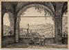
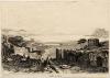
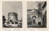
 | Vue de l´Albergo
by nn | 1750ca | 21,5 X 15,5 cm | 37 euro
| |
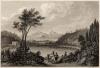
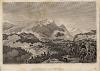
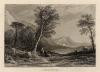
 | Italiaans uitzicht
by C. Bourgeois, F. Delpech | 1824 | 24,5 X 17,5 cm | 16 euro
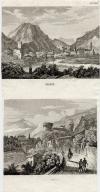
| | Aosta
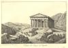
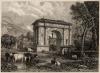 | Der Triumphenbogen des Augustus bey Aosta.
by nn | 1850ca | 14 X 10 cm | 26 euro
| | Assisi
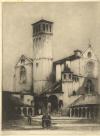 | St. Francesco Assisi
by Louis Wherter | 1926 | 14 X 18,5 cm | 21 euro
| | Averno
 | Lago d´ Averno
by C. Reiss, b. Metzeroth | 1850ca | 15 X 10 cm | sold
| | Baia
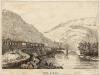
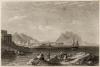
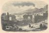
 | Golfe de Baïa
by Buttura, Lacauchie | 1836 | 16 X 11 cm | 37 euro
| | Bard
 | Défilé de Bard
by Lacouchie | 1835ca | 12 X 9 cm | 21 euro
| | Bologna
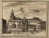 | Palais du Gouverneur � Boulogne
by Alexandre de Rogissart | 1707 | 18 X 14 cm | 37 euro
| | Bolzano, Bozen
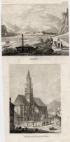 | Botzen, Pfarrkirche in Botzen
by nn | 1850ca | 10 X 20 cm | sold
| | Bormio
 | Das Addathal am Wormserbad
by nn | 1840ca | 15 X 11 cm | 52 euro
| | Bressanone, Brixen
 | Festung Bresseone (Franzenveste)
by nn | 1850ca | 16 X 13 cm | 32 euro
| | Capo Colonna
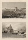
 | Cap Colonne
by naar W. Purser | 1840ca | 14 X 11 cm | 21 euro
| | Catania, Sicilia, Etna
 | Catanea und Der Aetna
by C. Reiss, I.G. Martini | 1843 | 15 X 10 cm | 37 euro
| | Como, Lake Como
 | Como am Comer see in Italien
by nn | 1850ca | 15 X 11 cm | sold
| | Dégò
 | Dégò
by Fleury | 1825ca | 11 X 8,5 cm | 26 euro
| | Firenze, Florence:
2 items | Visit our page of the city of Firenze, Florence | Florence:
3 items | Visit our page of the city of Florence | Frescada
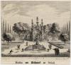 | Machina von Wasserwerde zu Frescadj.
by Melchior Küsell, J.W. Baur | 1681ca | 20 X 18,5 cm | 78 euro
| | Genua:
2 items | Visit our page of the city of Genua | Genua, Genoa
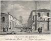
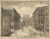 | Vue de la Place de Banchi
by Gio. Lor. Guidotti | 1750ca | 20 X 16 cm | 32 euro
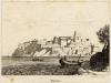
| | Herculaneum
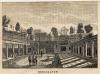 | Herculanum
by Louis-Eustache Audot | 1835ca | 16 X 11,5 cm | 42 euro
| | Ischia
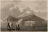 | Die Insel Ischia bei Neapel
by C. Reiss | 1850ca | 15 X 10 cm | 42 euro
| | Isola Bella:
2 items | Visit our page of the city of Isola Bella | Jaillon, Piemonte
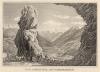
 | Head of the valley of Jaillon (Piedmont)
by J. Cousen, W. Brockedon | 1838 | 17,5 X 14 cm | 32 euro
| | Lugo
 | Lugo
by nn | 1850ca | 15 X 10 cm | 32 euro
| | Mantua:
3 items | Visit our page of the city of Mantua | Messina:
2 items | Visit our page of the city of Messina | Milaan
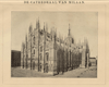 | Cathedraal van Milaan
by Winkler Prins | 1909 | 22 X 14 cm | 9 euro
| | Milaan, Milan:
4 items | Visit our page of the city of Milaan, Milan | Milaan, Milano
 | Mayland
by nn | 1850ca | 15 X 10 cm | 47 euro
| | Millesimo
 | Millesimo
by Fleury, Boullemie | 1840ca | 11,5 X 8,5 cm | 21 euro
| | Mortola
 | Mortole (Piemont)
by nn | 1850ca | 16,5 X 13 cm | 32 euro
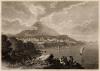
| | Napels:
5 items | Visit our page of the city of Napels | Napoli, Napule, Napels, Vesuvius
 | Neapel
by nn | 1850ca | 15 X 10 cm | 42 euro
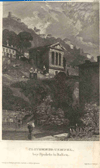
| | Nemi
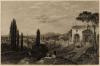
 | État Romain. Lac de Némi.
by Girard | 1850ca | 20 X 14,5 cm | 26 euro
| | Novi Ligure
 | Chateau de Novi
by Buttura, Lacauchie | 1840ca | 12 X 9 cm | 26 euro
| | Otranto
 | Otrante
by Buttura, Lacauchie | 1840ca | 11,5 X 9 cm | 26 euro
| | Palermo
 | Palermo
by nn | 1850ca | 15 X 10 cm | 32 euro
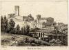
| | Piacenza
 | Placencia
by D. Roberts, R. Ford, R. Brandard | 1837 | 15,5 X 11,5 cm | 32 euro
| | Pisa:
5 items | Visit our page of the city of Pisa | Pompei
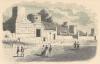 | Rue des tombeaux, a Pompei
by E. Breton, E. Bocquet | 1843 | 16,5 X 10,5 cm | 37 euro
| | Pompeii
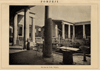 | Pompeji
by Winkler Prins | 1910 | 22 X 14 cm | 9 euro
| | Ponte Gardena:
2 items | Visit our page of the city of Ponte Gardena | Ravenna
 | Sepoloro di Teodorico, Tombeau de Théodoric, Ravenna, Sepoloro di Dante, Tombeau du Dante
by Lenormand, Audot, Bouchet, Durau | 1840ca | 20 X 13 cm | 52 euro
| | Rivoli
 | Bataille de Rivoli
by Couché, Bovinet | 1828 | 13 X 9,5 cm | 32 euro
| | Roma, Rome:
5 items | Visit our page of the city of Roma, Rome | Rome:
23 items | Visit our page of the city of Rome | Rome, Roma:
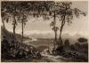
3 items | Visit our page of the city of Rome, Roma | Rome, Tivoli
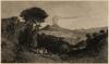
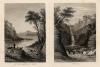 | In the campagna of Rome. Tivoli.
by nn | 1850ca | 14,5 X 10 cm | 32 euro
| | Rovereto:
2 items | Visit our page of the city of Rovereto | Scilla
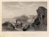 | Rock and promontory of Scylla, Calabria. Italy.
by T.B. Aylmer, W.J. Cooke | 1840ca | 20 X 15,5 cm | 42 euro
| | Segesta
 | Veduta del Tempio di Segesta
by F. Zevilli | 1830ca | 17,5 X 12 cm | 42 euro
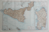
| | Sicilie, Sicily
 | View in Sicily
by nn | 1850ca | 9,5 X 7 cm | 21 euro
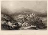
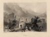
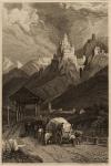
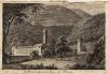
| | Spoleto
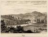
 | Clitumnus - Tempel bey Spoleto in Italien
by nn | 1850ca | 10 X 15 cm | sold
| | Susa
 | Susa
by W.H. Bartlett, G. Richardson | 1850ca | 17,5 X 13,5 cm | 37 euro
| | Syracuse:
2 items | Visit our page of the city of Syracuse | Taormina, Messina
 | Theatre de Taormina
by E. Breton, A. Mercier | 1843 | 16,5 X 11,5 cm | 32 euro
| | Terni:
2 items | Visit our page of the city of Terni | Tivoli:
2 items | Visit our page of the city of Tivoli | Trente, Rovereto
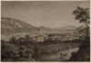
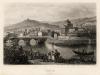
 | Trient, Roveredo
by nn | 1850ca | 10 X 21 cm | 16 euro
| | Trento, Trente:
2 items | Visit our page of the city of Trento, Trente | Trento, Trient:
2 items | Visit our page of the city of Trento, Trient | Triest
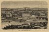
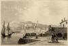 | Triest
by nn | 1850ca | 15 X 10 cm | 42 euro
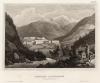
| | Trostberg
 | Bergveste Trostberg in Tyrol
by I.G. Martini | 1836 | 9 X 15 cm | 37 euro
| | Turijn
 | Turin Italie
by J. Schroeder | 1859 | 16 X 12 cm | 42 euro
| | Turijn, Turin
 | Turijn, van den Capucijnerberg gezien
by nn | 1888 | 18 X 12 cm | 26 euro
| | Turin, Torino, Turijn
 | Turin
by C. Reiss | 1850ca | 15 X 10 cm | 32 euro
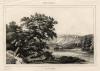
| | Vallombrosa
 | Vallombrosa à six lieves de Florence
by J.A. Darnstedt | 1804 | 12,5 X 8,5 cm | 11 euro
| | Venetië (Venice)
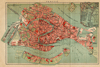 | Venetië
by Winkler Prins | 1911 | 34 X 22 cm | 68 euro
| | Venetie
 | Depositi dei Metalli
by Giovanni Pividor | 1836 | 13,5 X 11 cm | 68 euro
| | Venetie, Rome, Venice
 | Ruined temple near Rome. Venice.
by W. Havell, F.J. Havell | 1840ca | 9,5 X 14 cm | 37 euro
| | Venetie, Venice:
46 items | Visit our page of the city of Venetie, Venice | Venice, Venezia, Venise, Venetiam Venezsia:
4 items | Visit our page of the city of Venice, Venezia, Venise, Venetiam Venezsia | Verona
 | Verona
by nn | 1850ca | 15 X 10 cm | 52 euro
| |
| |


 follow us on facebook