|
last update: Jun-01-2026
Maps of France on atlasandmap.com |
| Title/Maker | Year | Measures | Price | |
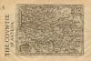
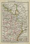
| ") | Frankrijk (Natuurkundig)
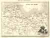
by Winkler Prins | 1907 | 28 X 22 cm | 13 euro | |  | Frankrijk
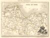
by Winkler Prins | 1907 | 22 X 28 cm | 13 euro | |  | Marseille
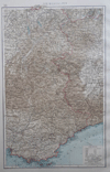
by Winkler Prins | 1909 | 14 X 22 cm | 16 euro | |  | Les Deux Cercles du Haut et Bas Rhin
by Buffier | 1739 | 14 X 18 cm | 21 euro | |  | Guiana, Noord-Brazilië
by Kuyper (Kuijper) | 1882 | 20 X 15,5 cm | 23 euro | |  | Frankreich, Südliche hälfte
by Richard Andree | 1896 | 46 X 38 cm | 23 euro | |  | übersichtskarte von Frankreich
by Richard Andree | 1896 | 47 X 38 cm | 23 euro | |  | Nordost Frankreich
by Richard Andree | 1896 | 50 X 40 cm | 23 euro | |  | Frankreich, Nordliche hälfte
by Richard Andree | 1896 | 46 X 38 cm | 23 euro | |  | Royaume de France, divise en 86 Departements
by Félix Delamarche | 1833 | 35 X 26 cm cm | 26 euro | |  | France par Provinces
by A. Vuillemin, Lale | 1850ca | 26,5 X 20,5 cm | 26 euro | |  | Frankrijk
by A. Baedeker, Rotterdam | 1844 | 26 X 22 cm | 32 euro | |  | Frankrijk in 1180, 1461, 1789, van 1610-1790
by P.W.M. Trap | 1876 | 28 X 22 cm | 32 euro | |  | Frankrijk
by F. Bruins | 1884 | 28 X 22 cm | 32 euro | |  | Gaule Independante er Romaine
by Desbuisson, A.T. Chartier | 1881 | 37 X 31 cm | 37 euro | |  | Le pays de Bourges ou Berry, Biturigum
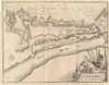
by Barent Langenes | 1609 | 13 X 9,5 cm | 37 euro | |  | Royaume de France divise en ses 32 Provinces avant 1790
by Félix Delamarche | 1833 | 35 X 26 cm cm | 42 euro | |  | France from the latest Authorities
by Thomas Kitchen | 1790ca | 22.5 X 19.5 cm | 42 euro | |  | France Féodale
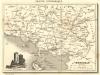
by Migeon, Sengteller, Desbuissons | 1881 | 37 X 30 cm | 42 euro | |  | France en 1789, donnant la comparaison des anciennes Provinces et des Départements actuels
by Migeon, Sengteller, Desbuissons | 1881 | 37 X 30 cm | 42 euro | |  | France Physique
by Migeon, Sengteller, Desbuissons | 1881 | 37 X 30 cm | 42 euro | |  | France par Départements
by Migeon, Sengteller, Desbuissons | 1881 | 37 X 30 cm | 42 euro | |  | Limousin, Limania
by Barent Langenes | 1609 | 13 X 9,5 cm | 42 euro | |  | Frankrijk
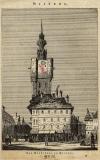
by P.W.M. Trap | 1872 | 28,5 X 23 cm | 42 euro | |  | Beauvais
by Jan de Lat | 1741 | 24 X 15 cm | 47 euro | |  | Vermandois, Veromadui
by Barent Langenes | 1609 | 13 X 9,5 cm | 47 euro | |  | Colonies Francaises
by Delamarche | ca 1830 | 43 X 29 cm cm | 52 euro | |  | Galliae Antique
by Félix Delamarche | 1833 | 39 X 26 cm cm | 52 euro | |  | Campania, Champagne
by Gerhard Mercator en Johannes Cloppenburg | 1636 | 25,5 X 17,5 cm | 52 euro | |  | Champagne
by Jan de Lat | 1741 | 23 X 15 cm | 52 euro | |  | The countrie of Bellovacum/ Belovacium Comitatus
by Gerhard Mercator en Johannes Cloppenburg | 1636 | 25 X 16,5 cm | 68 euro | |  | Cadurcium
by Gerhard Mercator, Johannes Cloppenburg | 1636 | 24 X 16 cm | 68 euro | |  | A new and correct map of France, Drawn from the latest Authorities
by Thomas Bowen | 1770ca | 29 X 22 cm | 73 euro | |  | Bituricum Ducatis; Duche de Berri
by W. Blaeu | 1635ca | 59 X 47 cm | 125 euro | |  | Arcihiepiscopatus Cameracensis Archevesche de Cambray
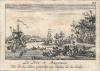
by J. Janssonius | 1647 | 59,5 X 49 cm | 145 euro | |  | Carte des Isles Antilles on du Vent avec la partie orientale Des Isles Sou le Vent
by Rigobert Bonne | 1782 | 21 X 32 cm | 156 euro | |  | Artesia, Comitatus. Artois
by J. Janssonius | 1647 | 60 X 38 cm | 156 euro | |  | Ager Parisiensis Vulgo L´Isle De France
by F. de la Guillotiere, P. Pithou; Blaeu | 1640ca | 48 X 34 cm | 156 euro | |  | Le Gouvernement de L´Isle de France
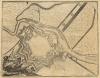
by Damien de Templeux, Willem en Joan Blaeu | 1635ca | 51 X 41 cm | 187 euro | |  | Plan de la Ville de Bouchain
by Anna Beek, Pieter Mortier | 1711ca | 57 X 49 cm | 207 euro | |  | Galliae Nova et Accurata descriptio Vulgo Royaume de France
by J. Janssonius | 1650ca | 56 X 45 cm | 207 euro | |  | Illustrissimo celsissimoque principi Carolo Emanueli D. G. Sabaudiae Duci, Pedemontii principi
by Frederick de Wit | 1680ca | 48 X 57 cm | 466 euro | |  | Kaart Frankrike.
by Stieler | 1868 | 24,5 X 21 cm | sold | |  | Frankrijk 1360 - 1610, Italie 1300 - 1600
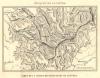
by De Erven Thierry en Mensing | 1858 | 31,5 X 22 cm | sold | |  | Parijs en Omstreken
by Winkler Prins | 1910 | 27 X 22 cm | sold | |  | Galliae Veteris Typus
by Koeman: Ja-10-13 | 1700 | 48.5 X 39 cm | sold | |  | Emipre Francais en 1811
by Migeon, Sengteller, Desbuissons | 1881 | 37 X 30 cm | sold | |  | Alpenkaart
by F. Bruins | 1884 | 28 X 22 cm | sold | |  | Lotharingia Septentrional
by Gerhard Mercator en Jan Jansson | 1651 | 20,5 X 14 cm | sold | |  | Gallia Vetus
by Papierformaat is 66 X 54 cm\r\nKoeman: Ja-10-14 | 1700 | 49.5 X 37 cm | sold | |  | Tabula Italiae Corsicae, Sardiniae, et adjac
by Wit, Frederik de | 1670 | 54.5 X 45 cm | sold | |
Maps of regions in France on atlasandmap.com |
| Region | Title/Maker | Year | Measures | Price | |
|
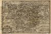
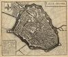
 | The countie of Artesia
by Gerhard Mercator en Jodocus Hondius | 1637 | 21 X 14 cm | 68 euro
| |
 | The countie of Pertica; Perchensis Comitatus; La Perche Comte
by Gerhard Mercator en Jodocus Hondius | 1637 | 25 X 17 cm | 68 euro
| |
 | Colonies Francaises (en Amérique)
by V. Levasseu, Burty | 1854ca | 42,5 X 29 cm | 52 euro
| |
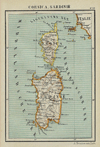 | Corsica, Sardinie
by Kuyper (Kuijper) | 1880 | 10 X 15 cm | 47 euro
| |
 | Utriusque Burgundiae tum Ducatus tum Comitatus descriptio
by Mattheus Merian | 1695 | 33 X 26 cm | 42 euro
| |
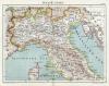 | Italië (Noord)
by Kuyper (Kuijper) | 1880 | 20 X 15 cm | 32 euro
| |
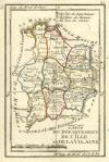 | Carte du departement de l´Ille et de la Vilaine
by nn | 1793 | 9,5 X 15 cm | 32 euro
| |
 | Vues de l ancien eveche de Bale
by E. Kappelin | 1860ca | 25 X 33 cm | 26 euro
| |
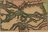
 | Loire Inferieure
by C.V. Monin | 1835 | 18 X 14 cm | 26 euro
| |
 | Seine Inferieure
by C.V. Monin | 1835 | 18 X 14 cm | 26 euro
| |
 | Ille et Vilaine
by C.V. Monin | 1835 | 13 X 18 cm | 26 euro
| |
 | Finistere
by C.V. Monin | 1835 | 18 X 14 cm | 26 euro
| |
 | Cotes du Nord
by C.V. Monin | 1835 | 18 X 13,5 cm | 26 euro
| |
 | Cotes du Nord
by C.V. Monin | 1835 | 18 X 13,5 cm | 26 euro
| |
 | Die Westalpen
by Richard Andree | 1896 | 23 X 37 cm | 23 euro
| |
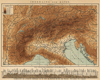 | Indeeling der Alpen
by Winkler Prins | 1895ca | 28 X 23 cm | 21 euro
| |
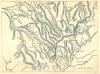
 | Du Chemin de Fer De Paris a Rouen
by P. Tardieu | 1844 | 20,5 X 13 cm | 21 euro
| |
 | Morbihan
by A. Fayard | 1877 | 25 X 19 cm | 21 euro
| |
 | Departement de la Loire Inferieure
by nn | 1850ca | 17 X 11 cm | 21 euro
| |
 | Departement d´Ille et Vilaine
by nn | 1850ca | 11 X 17 cm | 21 euro
| |
 | Departement de la Seine Inferieure
by nn | 1850ca | 11 X 17 cm | 21 euro
| |
 | Seine Inferieure
by A. Fayard | 1877 | 24 X 19 cm | 21 euro
| |
 | Frankrijk (Noorwest)
by Kuyper (Kuijper) | 1880 | 19 X 15 cm | 19 euro
| |
 | Frankrijk (Zuid)
by Kuyper (Kuijper) | 1880 | 19 X 15 cm | 19 euro
| |
 | Frankrijk (Noordoost)
by Kuyper (Kuijper) | 1880 | 10 X 15 cm | 19 euro
| |
 | Carte de chaine des montagnes de Langres
by Buffon | 1880ca | 16,5 X 11,5 cm | 16 euro
| |
 | Langres, Troyes, Sens, Dijon, Gray, Besancon
by Buffon? | 1880ca | 16,5 X 11,5 cm | 16 euro
| |
 | Morbihan
by C.V. Monin | 1835 | 18 X 14 cm | sold
| | Belgium
 | Gallia
by Weigel, Christoph (Witwe) | 1720 | 38 X 31 cm | sold
| |
Plans of cities in France on atlasandmap.com |
| Town | Title/Maker | Year | Measures | Price | |
|
 | Cliniques de l´école de médécine
by J. Claye naar H. Blaise | 1850ca | 17 X 13,5 cm | 26 euro
| |
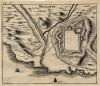
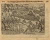
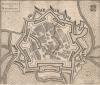
 | Grevelingen, Calais, Arras, St. Omer, Bethune, Bouchain
by nn | 1700ca | 12,5 X 18 cm | 47 euro
| |
 | The Pyrenees from the Great Plain of Languedoc
by nn | 1849 | 13 X 8 cm | 11 euro
| |
 | Lavandieres de l´Erdre
by H. Landrin, Sarazin | 1850ca | 19,5 X 13 cm | 37 euro
| | Abbeville:
3 items | Visit our page of the city of Abbeville | Aire-sur-la-Lys
 | Aire
by Eugene Sadoux | 1881 | 16 X 14 cm | 42 euro
| | Ambleteuse
 | Fort d�Ambleteuse
by Lacauchie, naar Buttura | 1836 | 11,5 X 8,5 cm | 16 euro
| | Amiens:
3 items | Visit our page of the city of Amiens | Ardres, Boulogne-sur-Mer
 | Ardres, Boulongne
by Mathias Merian | 1650ca | 16 X 11,5 cm | 88 euro
| | Arques
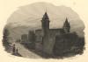
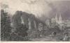
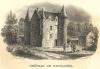
 | Chateau d´Arques
by Gaucherel, Lemaitre | 1845 | 10 X 13,5 cm | 26 euro
| | Arras:
3 items | Visit our page of the city of Arras | Auch
 | City of Auch, Pyrenees
by A. Willmore, naar T. Allom | 1846 | 20 X 15 cm | 37 euro
| | Avesnes-sure-Helpe
 | Avesnes
by Lodovico Guicciardini | 1612 | 17 X 13,5 cm | 42 euro
| | Avignon
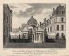
 | Avignon, Ch�teau des Papes
by J. Schroeder | 1859 | 16 X 11 cm | 26 euro
| | Béthune
 | Das Stadthaus zu Bethune
by nn | 1840ca | 13,5 X 21 cm | 16 euro
| | Bayonne
 | Le Port de Bayonne. Vu de la rive gauche au debus de la Ville
by nn | 1780ca | 10 X 6 cm | 32 euro
| | Bergues/ Sint-Winoksbergen:
3 items | Visit our page of the city of Bergues/ Sint-Winoksbergen | Blain
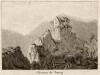
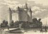
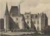
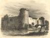
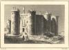
 | Chateau de Blain
by Rauch, Devilliers | 1840ca | 10,5 X 8 cm | 37 euro
| | Blois:
3 items | Visit our page of the city of Blois | Bordeaux:
3 items | Visit our page of the city of Bordeaux | Boulogne
 | Boulogne
by Couche, Fortier | 1835 | 11,5 X 8,5 cm | 32 euro
| | Boulogne-sur-Mer
 | Boulogne
by Jacob van Meurs | 1679 | 14,5 X 12,5 cm | 52 euro
| | Bourg
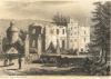
 | Chateau de Bourg
by nn | 1825ca | 16,5 X 12,5 cm | 16 euro
| | Brest:
6 items | Visit our page of the city of Brest | Caen:
10 items | Visit our page of the city of Caen | Calais:
6 items | Visit our page of the city of Calais | Camblain-Chatelain
 | Chateau de Camblin
by Rauch, Ransonnette | 1840ca | 10,5 X 7 cm | 26 euro
| | Cambrésis, Kamerijk
 | Cambrésis, Kamerijk: Sous Philippe 2, gouvernat le Pr. de Parme & l´Archid. Matthias,
by Willem Baudartius | 1625ca | 18 X 13 cm | 37 euro
| | Carnac:
4 items | Visit our page of the city of Carnac | Caudebec-en-Caux:
2 items | Visit our page of the city of Caudebec-en-Caux | Chalons-en-Champagne
 | Virtutis praemia cultur habet
by Daniel Meisner | 1626 | 15,5 X 10,5 cm | 73 euro
| | Chambord
 | Chateau de Chambord, near Blois
by T. Allom, J.Tingle | 1870 | 19,5 X 13,5 cm | 52 euro
| | Chateau le Puy
 | Chateau de Puy
by nn | 1850ca | 15 X 10 cm | 21 euro
| | Chateaulin
 | Chateaulin
by De la Pylaie, Schroeder | 1850ca | 10,5 X 7,5 cm | 26 euro
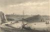
| | Cherbourg
 | Cherbourg
by Skelton | 1840ca | 15 X 9 cm | 26 euro
| | Cherbourg-Octeville
 | Plan of Cherbourg, with the forts and batteries when taken by the English in August 1758
by J. Cary | 1780ca | 24 X 18 cm | 42 euro
| | Chinon
 | Castle of Chinon, Indre-et-Loir
by T. Allom, S. Fisher | 1870 | 19,5 X 13,5 cm | 52 euro
| | Clermont-Ferrand
 | Clermont et le Pay de D�me
by Gilquin et Dupain, J. Schroeder | 1850ca | 16,5 X 13 cm | 26 euro
| | Clisson:
2 items | Visit our page of the city of Clisson | Combourg
 | Chateau de Combourg, Lieu de Naissance de Mr. de Chateaubriand
by Rauch, Nyon | 1840ca | 11 X 8 cm | 32 euro
| | Coutances
 | Coutances
by Skatton | 1840ca | 15 X 9 cm | 26 euro
| | Crozon
 | Bourg et Grotte de Crozon
by De la Pylaie, Schroeder | 1840ca | 10,5 X 7,5 cm | 32 euro
| | Dieppe:
6 items | Visit our page of the city of Dieppe | Dinan
 | Chateau de Leon a Dinan
by Bullura, Descaux | 1835 | 12 X 9 cm | 32 euro
| | Divonne-les-Bains
 | Cour d´entree de l´etablissement hydrotherapique de Divonne
by C.F. Nanteuil | 1856 | 18 X 13 cm | 32 euro
| | Dordogne
 | Die Kettenbrucke uber die Dordogne
by C. Reiss | 1850ca | 15 X 10 cm | 37 euro
| | Douai
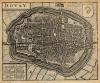 | Dovay
by Lodovico Guicciardini | 1635 | 15 X 13 cm | 47 euro
| | Dreux
 | Chapel of Dreux - the Mausoleum of the Orleans family
by T. Allom, H. Adlard | 1875 | 19,5 X 13,5 cm | 52 euro
| | Duinkerke:
3 items | Visit our page of the city of Duinkerke | Duinkerken
 | Duynkerck
by Lodovico Guicciardini | 1641 | 20 X 14 cm | 83 euro
| | Elven
 | Tour d´Elven
by De la Pylaie, Schroeder | 1838 | 10,5 X 7,5 cm | 42 euro
| | Etretat
 | Die Felsen von Etretat oder das Neptuns-Thor an der Normannischen Kuste
by nn | 1850ca | 15 X 10 cm | 16 euro
| | Eu
 | Eu (vue de la Ville et du Chateau)
by Morel, Outhwaite | 1840ca | 14,5 X 9 cm | 26 euro
| | Evreux
 | Evreux
by Outhwaite, Morel | 1844 | 14,5 X 9 cm | 37 euro
| | Faou
 | Le Faou
by De la Pylaie, Schroeder | 1838 | 11 X 7 cm | 37 euro
| | Finistere
 | Pointe et Fort Berthaume, qui ferme a l´Est le Goulet de Brest
by Rauch, Chavenes | 1835 | 10 X 7 cm | 37 euro
| | Florac
 | Florac
by J. Schroeder | 1838 | 11 X 8,5 cm | 47 euro
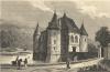
| | Fontaine Henry
 | Chateau de Fontaine Henri
by Rauch, Ransonnette | 1838 | 10,5 X 8 cm | 37 euro
| | Fontainebleau
 | Vue de la Porte du Donjon du Palais Royal de Fontainebleau
by Ducarme, naar Hugues | 1830ca | 23 X 19 cm | 16 euro
| | Fontaines
 | Chateau de Fontaines
by De la Pylaie, Schroeder | 1838 | 11,5 X 7 cm | 37 euro
| | Fouday
 | Foudai, Ban de la Roche
by E. Finden, naar W. Brockedon | 1837 | 19,5 X 15 cm | 26 euro
| | Fougeres:
2 items | Visit our page of the city of Fougeres | Givet:
3 items | Visit our page of the city of Givet | Givet, Charlemont
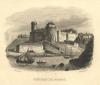
 | Charle-Mont
by J. Harrewijn | 1720ca | 18 X 14 cm | 52 euro
| | Gravelines
 | La ville de Gravelines
by Harrewijn | 1743 | 19 X 15 cm | 26 euro
| | Grevelingen, Gravelines
 | Grevelinge
by Braun, Hogenberg | 1575ca | 24 X 16,5 cm | 94 euro
| | Guines
 | Guines Geplondert
by nn | 1650ca | 13,5 X 11 cm | 42 euro
| | Guingamp
 | Guingamp
by Bullura, Desouloc | 1835 | 12 X 9 cm | 32 euro
| | Harfleur
 | Harfleur
by Couche, Chamoin | 1835 | 11,5 X 8 cm | 32 euro
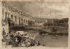
| | Havre
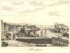
 | View near Havre
by J. Cousen, naar C. Stanfield | 1840ca | 15 X 12 cm | 52 euro
| | Hochstett:
2 items | Visit our page of the city of Hochstett | Honfleur:
4 items | Visit our page of the city of Honfleur | Huningue
 | Huningue, Est une Forteresse a cinq Bastions depuis peu bastie par le Roy,
by H. van Loon, N. de Fer | 1696 | 28 X 20 cm | 57 euro
| | Ille et Vilaine
 | Vue de la Vilaine, pres du Chateau de Silz
by J. Tasle, Schroeder | 1838 | 13,5 X 9 cm | 32 euro
| | Josselin
 | Josselin (Morbihan)
by nn | 1850ca | 11 X 16 cm | 32 euro
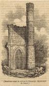
| | La Roche-aux-Fees
 | La Roche aux fees
by Duc | 1835 | 11 X 8,5 cm | 32 euro
| | La Roche-Bernard:
2 items | Visit our page of the city of La Roche-Bernard | La Seilleraye (Carquefou)
 | Chateau de la Sailleraye, Habitation de Mr. de Bec de Lievre
by Rauch, Skelton | 1838 | 13,5 X 9 cm | 26 euro
| | Lamballe
 | Lamballe
by Bullura, Desouloc | 1835 | 12 X 9 cm | 32 euro
| | Landerneau:
3 items | Visit our page of the city of Landerneau | Landreci:
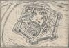
2 items | Visit our page of the city of Landreci | Landrecies
 | Plan de la Ville Landrecy
by P. Husson, B. van Zijl | 1710ca | 36,5 X 26 cm | 63 euro
| | Lanleff
 | Temple de Lanleff
by Rauch, Schroeder | 1838 | 10,5 X 7 cm | 32 euro
| | Le Four
 | Le Four
by Rauch, Schroeder | 1838 | 14 X 9 cm | 42 euro
| | Le Havre:
5 items | Visit our page of the city of Le Havre | Le Pallet
 | Chateau de la Galissoniere
by Rauch, Schroeder | 1838 | 10,5 X 8 cm | 32 euro
| | Le Puy-en-Velay
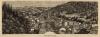
 | Puy-en-Velay mit seiner Umgegend
by Jung, Goldhann | 1834 | 15,5 X 9 cm | 37 euro
| | Le Quesnoy
 | Quercetum Vulgo Quesnoy
by nn | 1700ca | 29 X 24,5 cm | 42 euro
| | Le Treport
 | Arrivee de la Reine d´Angleterre au Treport
by Morel, Outhewaite | 1845ca | 14,5 X 10 cm | 26 euro
| | Le-Puy-en-Velay
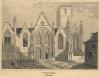
 | Cathédrale du Puy en Velay, département de la Haute-Loire
by nn | 1838 | 15 X 21 cm | 16 euro
| | Legue
 | Vue du Legue, pres de St. Brieuc
by Rauch, De la Pylaie, Skelton | 1838 | 10 X 7 cm | 32 euro
| | Lehon
 | Chateau de Lehon
by De la Pylaie, Schroeder | 1838 | 10,5 X 7 cm | 32 euro
| | Les Andelys:
2 items | Visit our page of the city of Les Andelys | Leseillon
 | Bergfestung Lesseillon und die Cenis-Strasse in den Savoyischen Alpen
by C. Reiss, B. Metzeroth | 1850ca | 15 X 10 cm | 16 euro
| | Lille
 | Lille - Rijssel
by Lodovico Guicciardini | 1660ca | 14 X 12 cm | 47 euro
| | Limoux
 | Limoux
by Nyon, naar Rauch | 1834 | 11,5 X 10 cm | 47 euro
| | Lisieux
 | VIew of the cathedral of Lisieux in Normandy
by nn | 1783 | 11,5 X 19 cm | 32 euro
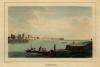
| | Lorient
 | Port de Lorient
by Bullura, Couche | 1835 | 11,5 X 8,5 cm | 37 euro
| | Lyon
 | Lyon
by nn | 1850ca | 15 X 10 cm | 21 euro
| | Mühlhausen
 | Mühlhausen
by J.L. Aubrun | 1865 | 5 X 9 cm | 16 euro
| | Marigny
 | Site et chateau de l´ancien marigny
by De la Pylaie, Schroeder | 1838 | 11 X 7,5 cm | 32 euro
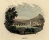
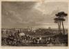
| | Marseilles
 | Tuna Fishing At Sunrise Off The Coast Near Marseilles
by Felix Ziem, Boiloin | 1860ca | 24 X 17,5 cm | 52 euro
| | Maubeuge
 | Malobodium Vulgo Maubeuge
by Merian | 1659 | 29 X 24,5 cm | 52 euro
| | Mont Saint Michel
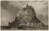 | Mont St Michel
by nn | 1850ca | 15 X 10 cm | 32 euro
| | Mont Saint-Michel:
4 items | Visit our page of the city of Mont Saint-Michel | Montargis
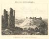
 | Derni�res ruines du ch�teau de Montargis, département du Loiret
by nn | 1838 | 8 X 13 cm | 16 euro
| | Montmorency
 | Eglise de Montmorency
by J. Schroeder, naar C. Rauch | 1838 | 10 X 9 cm | 21 euro
| | Montpellier
 | Montpellier
by C. Reiss, Poppel | 1850ca | 15 X 10 cm | 32 euro
| | Moulins
 | Moulins
by Nyon, naar Rauch | 1835ca | 14 X 10 cm | 42 euro
| | Nantes:
4 items | Visit our page of the city of Nantes | Neuf-Brisach
 | Brisach
by Cornelis Danckerts | 1700ca | 13 X 9 cm | 16 euro
| | Nice:
2 items | Visit our page of the city of Nice | Nimes
 | Das Amphitheater in Nismes
by nn | 1850ca | 15 X 10 cm | 16 euro
| | Orleans
 | Orleans
by C. Reiss, Martini | 1850ca | 17 X 10,5 cm | 26 euro
| | Péronne
 | Peronne
by Jacob van Meurs | 1690ca | 14 X 12,5 cm | 52 euro
| | Parijs:
28 items | Visit our page of the city of Parijs | Parijs, Paris:
5 items | Visit our page of the city of Parijs, Paris | Paris:
8 items | Visit our page of the city of Paris | Peronne
 | Peronne
by E. Finden, naar W. Brockedon | 1837 | 9,5 X 13 cm | 26 euro
| | Pierrefonds
 | Vue d´une des Tours du Ch�teau de Pierrefonds
by C. Constance, naar Deroy | 1830ca | 13 X 18 cm | 37 euro
| | Plastrier:
2 items | Visit our page of the city of Plastrier | Plestin-les-Gr�ves
 | Le Reliquaire de Plestin, en Bretagne
by nn | 1838 | 15,5 X 12 cm | 11 euro
| | Ploermel
 | Ploermel (Morbihan)
by nn | 1850ca | 11 X 8 cm | 26 euro
| | Plombières-les-Bains
 | Plombières
by nn | 1865ca | 24,5 X 9 cm | 16 euro
| | Polignac
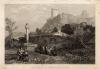 | Chateau & village de Polignac
by W.R. Smith, naar J.D. Harding | 1833 | 15,5 X 11,5 cm | 16 euro
| | Pornic
 | Chateau de Pornic
by Rauch, Schroeder | 1838 | 10,5 X 8 cm | 37 euro
| | Puissalicon
 | Clocher du Cimetiere de Puissalicon
by nn | 1840ca | 7,5 X 12,5 cm | 21 euro
| | Quimper:
2 items | Visit our page of the city of Quimper | Quimperle
 | Quimperle
by Rauch, Chavenes | 1838 | 13 X 8,5 cm | 32 euro
| | Rebus
 | Rebus
by nn | 1680ca | 16 X 11,5 cm | 37 euro
| | Redon
 | Tour de Redon (Ile et Vilaine)
by nn | 1850ca | 11 X 16 cm | 32 euro
| | Rennes:
2 items | Visit our page of the city of Rennes | Rouen:
22 items | Visit our page of the city of Rouen | Rouillon:
2 items | Visit our page of the city of Rouillon | Royat
 | Royat
by James B. Allen, naar J.D. Harding | 1840ca | 15,5 X 11 cm | 16 euro
| | Sézanne
 | Sezanne
by Christophe Tassin | 1635ca | 16 X 11,5 cm | 47 euro
| | Sélestat / Schlettstadt
 | Abiit quo nobile seclum
by Daniel Meisner | 1625ca | 15 X 10,5 cm | 78 euro
| | Saint - Malo
 | St Malo
by L. Daut | 1850ca | 16 X 10 cm | 32 euro
| | Saint Aubin du Cormier
 | Ruines du chateau de St. Aubin du Cormier
by De la Pylaie, Schroeder | 1850ca | 10,5 X 7 cm | 21 euro
| | Saint Marc sur Couesnon
 | Chateau de St Marc-Sur-Couesnon
by De la Pylaie, Skelton | 1838 | 10 X 7 cm | 32 euro
| | Saint Pol de Leon
 | Eglise de Creisker a Saint Pol de Leon
by Gaucherel, Lemaitre | 1842 | 10 X 15,5 cm | 32 euro
| | Saint-Brieuc:
2 items | Visit our page of the city of Saint-Brieuc | Saint-Nazaire
 | S. Nazaire
by Lacauchie | 1835 | 11,5 X 9 cm | 32 euro
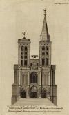
| | Saint-Omer / Sint Omaars
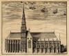
 | L´Eglise cathedrale de Saint Omer
by P. Devel | 1700ca | 21 X 15 cm | 42 euro
| | Saint-Point
 | Chateau de St. Point
by Lemaitre, naar Regnier | 1851 | 13 X 10 cm | 16 euro
| | Saint-Venant
 | Inname van Saint-Venant
by Pieter Schenk (I) | 1710 | 20 X 16,5 cm | 42 euro
| | Sainte-Foy-Tarentaise
 | Saint Foi (Val Isere)
by R. Wallis, W. Brockedon | 1836 | 18,5 X 14 cm | 21 euro
| | Saumur:
3 items | Visit our page of the city of Saumur | Scey-sur-Sa�ne
 | 1re vue du chateau de Beaufremont, a Scey sur Saone en Franche Comté
by Jean-Baptiste Lallemand | 1775ca | 23 X 17 cm | 37 euro
| | Sedan, Toul
 | Sedan en Champagne, Toul dans la Lorraine
by Pieter van der Aa | 1720ca | 16,5 X 12,5 cm | 52 euro
| | Sint Omaars, Saint Omer:
2 items | Visit our page of the city of Sint Omaars, Saint Omer | St. Cloud:
2 items | Visit our page of the city of St. Cloud | Suresnes
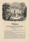 | Villa des enfants a Suresne
by Andrew Best & Leloir | 1840ca | 15 X 22 cm | 26 euro
| | Suscinio
 | Chateau de Sucinio
by Rauch, Schroeder | 1838 | 10,5 X 7,5 cm | 32 euro
| | Taden
 | Chateau de la Garaye
by Rauch, De la Pylaie, Skelton | 1838 | 10 X 7 cm | 26 euro
| | Tancarville:
3 items | Visit our page of the city of Tancarville | Thérouanne / Terwaan
 | L�église cathedrale de Notre Dame a Terouane
by Harrewijn | 1710ca | 19 X 15,5 cm | 42 euro
| | Thiers:
3 items | Visit our page of the city of Thiers | Toul
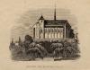
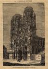 | La cathédrale de Toul
by nn | 1838 | 13,5 X 20,5 cm | 21 euro
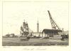
| | Toulon
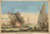 | Vue du port de Toulon
by Blondel | 1750ca | 47 X 32 cm | 130 euro
| | Troyes
 | Nulla fides dilectio nulla
by Eberhard Kieser | 1624 | 15 X 10,5 cm | 78 euro
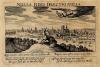
| | Valenciennes
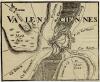 | Valenciennes
by nn | 1700ca | 18 X 14,5 cm | 42 euro
| | Valentiniana
 | Valentiniana
by Lodovico Guicciardini | 1652 | 14,5 X 13 cm | 52 euro
| | Vannes
 | Vannes
by Bullura, Chamoin | 1835 | 16 X 12 cm | 37 euro
| | Versailles:
2 items | Visit our page of the city of Versailles | Vitre:
2 items | Visit our page of the city of Vitre |
| |


 follow us on facebook