Rediscover your world at Atlas and Map
The place for your antique maps, plans, books and prints
Antique maps of Luxembourg
Only orginal maps an prints
On atlasandmap.com you can find
only original
items for sale
You will get a certificate of authenticity with each map or print:
HOME
-
MAPS
-
PRINTS
-
BOOKS
-
INFO
Antique maps of Luxembourg
last update: Jul-23-2021
Maps of Luxembourg on atlasandmap.com
Title/Maker
Year
Measures
Price
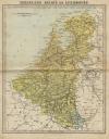
België en Luxemburg
by Winkler Prins
1906
27 X 22 cm
16 euro
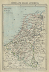
Nederland, Belgie, Luxemburg
by Kuyper (Kuijper)
1880
10 X 15 cm
19 euro
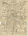
Carte du Departement de Luxembourg
by M. Robert
1748
21,5 X 16,5 cm
21 euro
Les Deux Cercles du Haut et Bas Rhin
by Buffier
1739
14 X 18 cm
21 euro
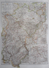
Rheinland und Westfalen, Fürstentümer Lippe und Grossherzogtum Luxemburg
by H. Mielisch, E. Umbreit
1896
37 X 53 cm
23 euro
Duitschland in ´t jaar 1512; De 10 kreitsen naar de verdeeling van keizer Maximiliaan 1, 1512
by P.W.M. Trap
1876
28 X 22 cm
32 euro
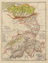
Belgie en Luxemburg, Zwitserland
by F. Bruins
1884
22 X 28 cm
32 euro
Nederland, Belgie en Luxemburg
by P.W.M. Trap
1872
23 X 28,5 cm
37 euro
Duche de Luxembourg
by nn
1750ca
23 X 15 cm
47 euro
carta nuova ed Accurata delle XVII Provincie de Paesi Bassi
by Isaac Tirion, G Albrizzi
1735ca
28 X 33.5 cm
187 euro
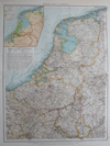
Niederlande und Belgien
by Richard Andree
1896
38 X 53 cm
sold
Duitschland onder de saksiche en frankische Keizers tot 1138
by P.W.M. Trap
1876
28 X 22 cm
sold
Pays Bas Catholiques
by Robert de Vaugondy
1784
15 X 15 cm
sold
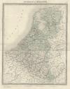
Belgique et Hollande
by Lemercier
1860ca
35 X 43 cm
sold
Ducatus Lutzenburgici Tabula Nuperrime In Lucem Edita Per Fredericum De Wit.
by Frederik de Wit
1670
56 X 46 cm
sold
Germanie Inferieure - Les Dixsept Provinces - Pays Bas
by Jan van Vianen?
1715ca
16.5 X 14.5 cm
sold
Gallia Belgica
by Abraham Ortelius
1601
11,5 X 9,5 cm
sold
Carta noua accurata del Passagio et strada dalli Paesi Bassi per via Allemagna per Italia et per via
by Frederik de Wit
1670
56 X 47 cm
sold
Maps of regions in Luxembourg on atlasandmap.com
Region
Title/Maker
Year
Measures
Price
Carte du Duche de Luxembourg
by M. Robert
1748
20 X 17,5 cm
21 euro
Carte du Departement de Luxembourg
by M. Robert
1748
20,5 X 16,5 cm
21 euro
Carte du Departement de Luxembourg
by M. Robert
1748
21 X 16,5 cm
21 euro
Plans of cities in Luxembourg on atlasandmap.com
Town
Title/Maker
Year
Measures
Price
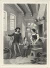
Hertog Filips de Goede ontvangt de hulde der Luxemburgsche Staten
by V. DeDoncker, A. Barbere
1882
15 X 13,5 cm
26 euro
Luxemburg:
5 items
Visit our page of the city of Luxemburg
Luxemburg, Luxembourg
View of Luxemburg
by nn naar Granger
1870ca
15,5 X 13 cm
21 euro
HOME
-
MAPS
-
PRINTS
-
BOOKS
-
INFO
New:
Maps
Provincie Noordbrabant
Kuyper maps
Gemeente Princenhage
Prints
Reinoud IIe agttiende heer van Brederode, door de Utrechtsche Bisschop, David van Bourgondien...
Townplans and views
Utrecht: La Ville d´Utrecht
Books and atlasses
FACSIMILE: Gemeente-Atlas van de provincie Friesland 1861
We are on facebook now:
follow us on facebook
for news, highlighted special items and items on your dutch roots.
sitemap
|
recent added
|
inspired by:
|
contact
|
RSS
|
|
privacy