Rediscover your world at Atlas and Map
The place for your antique maps, plans, books and prints
Antique maps of Croatia


HOME - MAPS - PRINTS - BOOKS - INFO
Antique maps of Croatia
last update: Nov-09-2020
Maps of Croatia on atlasandmap.com
Title/MakerYearMeasuresPrice
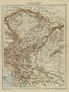
thmbnail of Karintië, Krain, Salzburg, Stiermarken, Tirol en VorarlbergKarintië, Krain, Salzburg, Stiermarken, Tirol en Vorarlberg
by Winkler Prins
190928 X 22 cm16 euro
thmbnail of Oostenrijk (Westelijk)Oostenrijk (Westelijk)
by Kuyper (Kuijper)
188020 X 15,5 cm19 euro
thmbnail of Turkije (Westelijk), Servië, MontenegroTurkije (Westelijk), Servië, Montenegro
by Kuyper (Kuijper)
188020 X 15,5 cm19 euro
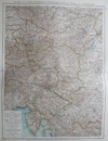
thmbnail of Nieder- und Ober- osterreich, Steiemark, Kärnten, Krain und KüstenlandNieder- und Ober- osterreich, Steiemark, Kärnten, Krain und Küstenland
by W. Berg
189638 X 51 cm23 euro
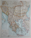
thmbnail of BalkanhalbinselBalkanhalbinsel
by Richard Andree
189637 X 47 cm23 euro
thmbnail of Balkan-SchiereilandBalkan-Schiereiland
by Winkler Prins
190527 X 23 cm26 euro
thmbnail of Hongarije en GaliciëHongarije en Galicië
by Winkler Prins
190828 X 22 cm26 euro
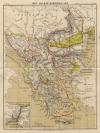
thmbnail of Het Balkan-SchiereilandHet Balkan-Schiereiland
by F. Bruins
188422 X 28 cm37 euro
thmbnail of La Turquie en Europe sur les observations de l´Academie des Sciences de ParisLa Turquie en Europe sur les observations de l´Academie des Sciences de Paris
by A. Faure
174418 X 14 cm52 euro
thmbnail of Empire d´Autriche (Empire Austro - Hongrois)Empire d´Autriche (Empire Austro - Hongrois)
by Migeon, Sengteller, Desbuissons
188139 X 31 cm52 euro
thmbnail of Ungarn und GalizienUngarn und Galizien
by J. Walch
1805ca25 X 20 cm125 euro
thmbnail of Ubersichtskarte von osterreich-UngarnUbersichtskarte von osterreich-Ungarn
by A. Thomas, E. Umbreit
189646 X 38 cmsold
information about map on atlasandmap.com
thmbnail of Ungarn und GalizienUngarn und Galizien
by A. Brandrupp, Ch. Peip, M. Oschmann
189648 X 39 cmsold
information about map on atlasandmap.com
thmbnail of Kaart   Polen, Galizien, Ungern, Kroatien, Siebenbürgen, Moldau och Wallachiet.Kaart Polen, Galizien, Ungern, Kroatien, Siebenbürgen, Moldau och Wallachiet.
by Stieler
186822,5 X 21 cmsold
information about map on atlasandmap.com
thmbnail of Bosnië, Dalmatië, Istrië, Kroatië en SlavoniëBosnië, Dalmatië, Istrië, Kroatië en Slavonië
by Winkler Prins
190628 X 22 cmsold
information about map on atlasandmap.com
thmbnail of Europeesch-Turkije en GriekenlandEuropeesch-Turkije en Griekenland
by Emrik & Binger
187223 X 28,5 cmsold
information about map on atlasandmap.com
thmbnail of Europisch Turkije en GriekenlandEuropisch Turkije en Griekenland
by A. Baedeker
185026,5 X 21,5 cmsold
information about map on atlasandmap.com

Maps of regions in Croatia on atlasandmap.com
RegionTitle/MakerYearMeasuresPrice
Croatia
Vindelicia Rheti
by Weigel, Christoph (Witwe)
172038.5 X 30.5 cmsold

Plans of cities in Croatia on atlasandmap.com
TownTitle/MakerYearMeasuresPrice
Batina
Battina an der Donau in Ungarn
by nn
1850ca15,5 X 12,5 cm21 euro
Ilok:
2 items
Visit our page of the city of Ilok

HOME - MAPS - PRINTS - BOOKS - INFO
New:
Maps
Provincie Noordbrabant

Kuyper maps
Gemeente Princenhage

Prints
Reinoud IIe agttiende heer van Brederode, door de Utrechtsche Bisschop, David van Bourgondien...

Townplans and views
Utrecht: La Ville d´Utrecht

Books and atlasses
FACSIMILE: Gemeente-Atlas van de provincie Friesland 1861

We are on facebook now:
follow us on facebook
for news, highlighted special items and items on your dutch roots.


sitemap | recent added | inspired by: kruisbestuiving: benut kennis optimaal - www.kuisbestuiving.nl | contact | RSS | | privacy