Worldmaps on Atlas and Map |
| Title/Maker | Year | Measures | Price | |
|
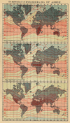 | Temperatuurvedeeling op de Aarde
by Winkler Prins | 1911 | 14 X 22 cm | 11 euro |
|
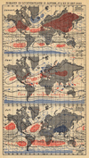 | Isobaren en luchtcirculatie in januari, juli en in het jaar
by Winkler Prins | 1908 | 14 X 22 cm | 13 euro |
|
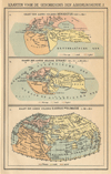 | Kaarten voor de geschiedenis der aardrijkskunde 1
by Winkler Prins | 1895ca | 14 X 22 cm | 16 euro |
|
 | Rijk en Veroveringstochten van Alexander den Grooten
by Winkler Prins | 1895ca | 27 X 22 cm | 21 euro |
|
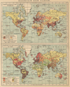 | Kaarten der Aarde
by Winkler Prins | 1900ca | 27 X 22 cm | 26 euro |
|
 | Kaarten voor de geschiedenis der aardrijkskunde II (2)
by Winkler Prins | 1895ca | 27 X 22 cm | 26 euro |
|
 | Eenheids- en plaatselijke tijd
by Winkler Prins | 1907 | 29 X 22 cm | 26 euro |
|
 | De verbreiding der Menschenrassen volgens F. Müller en O. Peschel
by Winkler Prins | 1909 | 27 X 22 cm | 26 euro |
|
 | Kolonial und Weltverkehrskarte Meerestömungen
by Richard Andree | 1896 | 47 X 37 cm | 29 euro |
|
 | Rivers and Mountains
by C.J.W. Russell and J Archer | 1840ca | 30 X 24 cm | 32 euro |
|
 | Charta öfver Jorden i Mercators Projection. Derjemte ss. charta öfver Australien och Polynesien.
by Stieler | 1868 | 23,5 X 19 cm | 32 euro |
|
 | Het Rijk van Alexander den Groote
by De Erven Thierry en Mensing | 1858 | 31,5 X 22 cm | 32 euro |
|
 | Wereldkaart (Grondgesteldheid en Wereldverkeer)
by F. Bruins | 1884 | 28 X 22 cm | 32 euro |
|
 | Wereldkaart, Mercator´s Projectie
by P.W.M. Trap | 1872 | 28,5 X 23 cm | 42 euro |
|
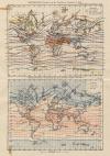 | Wereldkaart (Verdeeling der Warmte in Januari en Juli) (Verdeeling der gemiddelde Jaarl. warmte)
by F. Bruins | 1884 | 22 X 28 cm | 42 euro |
|
 | Zeestromingen
by Winkler Prins | 1912 | 27 X 22 cm | 47 euro |
|
 | Oestliche Halbkugel
by F. von Stulpnagel | 1878 | 30 X 31 cm | 63 euro |
|
 | Westliche Halbkugel
by F. von Stulpnagel | 1878 | 30 X 31 cm | 63 euro |
|
 | Historisk-Geografisk Atlas öfter Gamla verlden
by H. Kiepert, N.P. Nilsson | 1863 | 32 X 23.5 cm | 78 euro |
|
 | Planisphère
by Debuissons, Ch. Lacoste | 1884 | 37 X 29 cm | 114 euro |
|
 | Mappe-Monde en deux Hémisphères
by Migeon, Sengteller, Chartier | 1881 | 37 X 23 cm | 114 euro |
|
 | Typus Orbis Terrarum
by Abraham Ortelius | 1570 | 35 X 50 cm | sold |
|
 | Nova orbis tabula, in lucem edita, A.F. de Wit.
by Wit, Frederik de | 1670 | 46.5 X 54.5 cm | sold |
|
 | Atlas zur Physischen Geographie
by Karlheinz Wagner | 1971 | 21 X 30 cm | sold |
|
 | Atlas zur Ozeanographie
by Günter Dietrich, Johannes Ulrich | 1967 | 21 X 30 cm | sold |
|
 | Atlas zur Himmelskunde
by Karl Schaifers | 1969 | 21 X 30 cm | sold |
|
 | Atlas zur Geologie
by Erich Bederke, Hans-Georg Wunderlich | 1968 | 21 X 30 cm | sold |
|
 | Atlas zur Biogeographie
by Josef Schmithusen | 1976 | 21 X 30 cm | sold |
|
 | Atlas zur Bodenkunde
by Robert Ganssen, Friedhelm Hadrich | 1965 | 21 X 30 cm | sold |
|
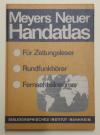 | Meyers Neuer Handatlas
by Rudolf Frohberg | 1963 | 21 X 30 cm | sold |
|
 | Epitome Theatri Orteliani
by Abraham Ortelius | 1996 | 15 X 11 cm | sold |
|
 | Overzichtskaart van de Koloniën der Europeesche staten.
by Winkler Prins | 1909 | 29 X 22 cm | sold |
|
 | Vestra Halfklotet en Ostra Halfklotet
by Stieler | 1868 | 27,5 X 20 cm | sold |
|
 | De Kruistogten
by De Erven Thierry en Mensing | 1858 | 31,5 X 22 cm | sold |
|
 | De belangrijkste ontdekkingstochten van de XVI-de eeuw tot het midden der XIX-de eeuw
by P.W.M. Trap | 1876 | 22 X 28 cm | sold |
|
 | Wereldkaart (Wind en Regen)
by F. Bruins | 1884 | 28 X 22 cm | sold |
|
 | Westliche und östliche Halbkugel
by Richard Andree | 1896 | 47 X 37 cm | sold |
|
 | Monde connu des anciens
by Debuissons, A.T. Chartier | 1881 | 37 X 31 cm | sold |
|
 | Wereldkaart
by P.W.M. Trap | 1872 | 28,5 X 23 cm | sold |
|
 | Wereldkaart (De Volken der Aarde)
by F. Bruins | 1884 | 28 X 22 cm | sold |
|
 | Geographia sacra
by Koeman: Ja-10-64 | 1700 | 47 X 36 cm | sold |
|
 | Wereldkaart
by A. Baedekker, Rotterdam | 1850 | 28 X 21 cm | sold |
|
 | Tableau Analytique def différens systemes du monde
by Félix Delamarche | 1833 | 44 X 28 cm cm | sold |
|
 | Mappe Monde
by Félix Delamarche | 1833 | 44 X 24 cm cm | sold |
|
 | Wereldkaart omtrent het einde de 16e Eeuw
by De Erven Thierry en Mensing | 1858 | 31,5 X 22 cm | sold |
|
 | A New Mercators chart Drawn from the latest discoveries
by W. Harrison, Wilkinson | 1800 | 45 X 27 cm | sold |
|
 | Tabulae peutingeriana 5&6
by Segement 5 en 6 Papierformaat is 66 X 54 cm\r\nOp de kaart staa | 1700 | 50 X 40 cm | sold |
|
 | Atlas des Enfans
by B. Vlam | 1776 | 10.5 X 17.5 cm | sold |
|
 | Platte Kaart van de geheele waereld om te dienen tot de Nederlandsche reizen
by Petrus Conradi en Volkert van der Plaats | 1785ca | 46 X 37.5 cm | sold |
|


 follow us on facebook