Rediscover your world at Atlas and Map
The place for your antique maps, plans, books and prints
Maps of North America


HOME - MAPS - PRINTS - BOOKS - INFO
Antique maps of North America

Title/MakerYearMeasuresPrice
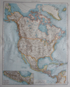
thmbnail of NordamerikaNordamerika
by Richard Andree
189637 X 48 cm23 euro
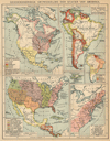
thmbnail of Geschiedkundige ontwikkeling der Staten van AmerikaGeschiedkundige ontwikkeling der Staten van Amerika
by Winkler Prins
1895ca22 X 28 cm26 euro
thmbnail of Nord-America und West-IndienNord-America und West-Indien
by Justus Perthes
1835ca24 X 19 cm32 euro
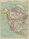
thmbnail of Noord-AmerikaNoord-Amerika
by Kuyper (Kuijper)
188220 X 15,5 cm32 euro
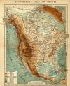
thmbnail of Natuurkundige kaart van AmerikaNatuurkundige kaart van Amerika
by Winkler Prins
1895ca21.5 X 28 cm32 euro
thmbnail of Mexico en de Vereenigde Staten van Noord-AmerikaMexico en de Vereenigde Staten van Noord-Amerika
by nn
187228,5 X 23 cm42 euro
thmbnail of Noord-AmerikaNoord-Amerika
by Emrik & Binger
187228,5 X 23 cm47 euro
thmbnail of Noord-AmerikaNoord-Amerika
by F. Bruins
188422 X 28 cm47 euro
thmbnail of Förenade Staterna i Nord-Amerika och MexicoFörenade Staterna i Nord-Amerika och Mexico
by Stieler
186826 X 21 cm63 euro
thmbnail of Norra America och Vest-IndienNorra America och Vest-Indien
by Stieler
186824 X 19 cm63 euro
thmbnail of Amérique SeptentrionaleAmérique Septentrionale
by Migeon, Sengteller, Desbuissons
188137 X 30 cm83 euro
thmbnail of Noord-AmerikaNoord-Amerika
by D. Heyse, A. Baedeker
1850ca26,5 X 21 cm125 euro
thmbnail of Noord-AmerikaNoord-Amerika
by A. Baedeker, Rotterdam
184421,5 X 26,5 cmsold
information about map on atlasandmap.com
thmbnail of Nova totius americae descriptioNova totius americae descriptio
by Wit, Frederik de
167055 X 44 cmsold
information about map on atlasandmap.com
thmbnail of Amérique SeptentrionaleAmérique Septentrionale
by Félix Delamarche
183331 X 26 cm cmsold
information about map on atlasandmap.com

Countries in North America

We have maps of most countries in North America. Click on a country for the available maps, townplans and townviews
Bahamas
Belize
Canada
El Salvador
Greenland
Guatemala
Honduras
Mexico
Nicaragua
Panama
Puerto Rico
United States
HOME - MAPS - PRINTS - BOOKS - INFO
New:
Maps
Kaarten voor de geschiedenis der aardrijkskunde II (2)

Kuyper maps
Gemeente Gouda

Prints
Reinoud IIe agttiende heer van Brederode, door de Utrechtsche Bisschop, David van Bourgondien...

Townplans and views
Roermond: Ruremunda Gelriea opp.

Books and atlasses
FACSIMILE: Gemeente-Atlas van de provincie Friesland 1861

We are on facebook now:
follow us on facebook
for news, highlighted special items and items on your dutch roots.


sitemap | recent added | inspired by: kruisbestuiving: benut kennis optimaal - www.kuisbestuiving.nl | contact | RSS | | privacy