Rediscover your world at Atlas and Map
The place for your antique maps, plans, books and prints
Old or Ancient world


HOME - MAPS - PRINTS - BOOKS - INFO
Antique maps of the Old or Ancient World
Here you can find maps of the Ancient world.
The Old World is the name for the timespan where the Roman, Greek and Gallian people dominated the world.
The maps show the empires cruisifades and wars
Most maps are from the area around the meditarian sea.

Maps of the Old World on Atlas and Map
TitleMakerYearMeasuresPrice
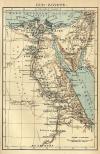
thmbnail of Oud-EgypteOud-Egypte
by Winkler Prins
190714 X 22 cm15 euro
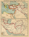
thmbnail of Diadochenrijken tegen het midden der 3e eeuw v. chr (247 v. Chr)Diadochenrijken tegen het midden der 3e eeuw v. chr (247 v. Chr)
by Winkler Prins
190722 X 29 cm16 euro
thmbnail of Het Byzantijnsche rijk omstreeks 1000 na Chr.Het Byzantijnsche rijk omstreeks 1000 na Chr.
by Winkler Prins
190629 X 22 cm21 euro
thmbnail of Het Romeinsche rijk ten tijde van zijn Grootsten omvang onder Trajanus (98-117 N.Chr)Het Romeinsche rijk ten tijde van zijn Grootsten omvang onder Trajanus (98-117 N.Chr)
by Winkler Prins
191027 X 22 cm26 euro
thmbnail of Carte de la dispersion des Peuples Apres le DelugeCarte de la dispersion des Peuples Apres le Deluge
by Félix Delamarche
183239 X 26 cm cm32 euro
thmbnail of Griekenland en zijne volkplantingen; Italie omstreeks 500Griekenland en zijne volkplantingen; Italie omstreeks 500
by P.W.M. Trap
187628 X 22 cm32 euro
thmbnail of Oud-Griekenland; AthenaeOud-Griekenland; Athenae
by P.W.M. Trap
187622 X 28 cm32 euro
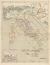
thmbnail of Oud-Italie; Latium;  CampaniaOud-Italie; Latium; Campania
by P.W.M. Trap
187628 X 22 cm32 euro
thmbnail of Gallia, Brittania, Rhaetia, Noricum, Pannonia, Germania; HispaniaGallia, Brittania, Rhaetia, Noricum, Pannonia, Germania; Hispania
by P.W.M. Trap
187628 X 22 cm32 euro
thmbnail of Het OostRomeinsche Rijk, het Osmanische Rijk, Het Latijnsche KeizerrijkHet OostRomeinsche Rijk, het Osmanische Rijk, Het Latijnsche Keizerrijk
by P.W.M. Trap
187628 X 22 cm32 euro
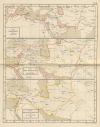
thmbnail of Veroveringen der Arabieren; Het Khalifaat der Arabieren; Rijken der Seldschuken voor Tschingis Khan Veroveringen der Arabieren; Het Khalifaat der Arabieren; Rijken der Seldschuken voor Tschingis Khan
by P.W.M. Trap
187622 X 28 cm32 euro
thmbnail of Tableau de la retraite des dix milleTableau de la retraite des dix mille
by Félix Delamarche
183340 X 27 cm cm52 euro
thmbnail of Peloponnesus sive MoreaPeloponnesus sive Morea
by Jacob van Meurs
168837 X 30,5 cm156 euro
thmbnail of Totius Orbis Terrarum Tabula Ejusque Post Diluvium Divisio Inter Filios NoachiTotius Orbis Terrarum Tabula Ejusque Post Diluvium Divisio Inter Filios Noachi
by J. Moxon
170934 X 21 cm311 euro
thmbnail of Imperii RomaniImperii Romani
by Félix Delamarche
183239 X 26 cm cmsold
information about map on atlasandmap.com
thmbnail of Alexandri MagniAlexandri Magni
by Félix Delamarche
183340 X 26 cm cmsold
information about map on atlasandmap.com
thmbnail of Aegyptus en Libya omstreeks 30 v.Chr.Aegyptus en Libya omstreeks 30 v.Chr.
by P.W.M. Trap
187628 X 22 cmsold
information about map on atlasandmap.com
thmbnail of Het Rijk van Alexander den Groote; Voor-Azië 600 v. Chr.;  Staten ontstaan uit het rijk... 190 v. CHet Rijk van Alexander den Groote; Voor-Azië 600 v. Chr.; Staten ontstaan uit het rijk... 190 v. C
by P.W.M. Trap
187628 X 22 cmsold
information about map on atlasandmap.com
thmbnail of Aarde volgens Homerus; Carthago; Eiland der Batavieren; Nineveh; Roma; Rome en CarthagoAarde volgens Homerus; Carthago; Eiland der Batavieren; Nineveh; Roma; Rome en Carthago
by P.W.M. Trap
187628 X 22 cmsold
information about map on atlasandmap.com
thmbnail of Het Romeinsche Rijk in zijn grootsten omvang onder Trajanus (98-117 n.Chr.)Het Romeinsche Rijk in zijn grootsten omvang onder Trajanus (98-117 n.Chr.)
by P.W.M. Trap
187628 X 22 cmsold
information about map on atlasandmap.com
thmbnail of De Bezittingen der Spanjaarden en Portugezen in de XVI-de Eeuw en de eerste grote OntdekkingstochtenDe Bezittingen der Spanjaarden en Portugezen in de XVI-de Eeuw en de eerste grote Ontdekkingstochten
by P.W.M. Trap
187622 X 28 cmsold
information about map on atlasandmap.com
thmbnail of Orbis Antiqua Mappa NovaOrbis Antiqua Mappa Nova
by Félix Delamarche
183242 X 26 cm cmsold
information about map on atlasandmap.com
HOME - MAPS - PRINTS - BOOKS - INFO
New:
Maps
Japan en Korea

Kuyper maps
Gemeente Waspik

Prints
Baron van Lijnden van Sandenburg, Ridder der Orde van den Nederlandschen Leeuw...

Townplans and views
Leiden: Lugdunum Batavorum, Leyden in Hollant

Books and atlasses
FACSIMILE: Gemeente-Atlas van de provincie Friesland 1861

We are on facebook now:
follow us on facebook
for news, highlighted special items and items on your dutch roots.


sitemap | recent added | inspired by: kruisbestuiving: benut kennis optimaal - www.kuisbestuiving.nl | contact | RSS | | privacy