Rediscover your world at Atlas and Map
The place for your antique maps, plans, books and prints
Antique maps of Oman


HOME - MAPS - PRINTS - BOOKS - INFO
Antique maps of Oman
last update: Dec-19-2022
Maps of Oman on atlasandmap.com
Title/MakerYearMeasuresPrice
thmbnail of RoemeniëRoemenië
by Kuyper (Kuijper)
188020 X 15,5 cm19 euro
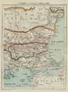
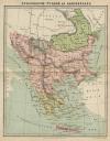
thmbnail of Turkije (Oostelijk), BoelgariëTurkije (Oostelijk), Boelgarië
by Kuyper (Kuijper)
188020,5 X 14,5 cm19 euro
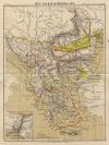
thmbnail of Historische kaart van het Oosters vraagstukHistorische kaart van het Oosters vraagstuk
by Winkler Prins
191027 X 22 cm23 euro
thmbnail of Roemenië, Bulgarije en ServiëRoemenië, Bulgarije en Servië
by Winkler Prins
191027 X 22 cm23 euro
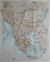
thmbnail of BalkanhalbinselBalkanhalbinsel
by Richard Andree
189637 X 47 cm23 euro
thmbnail of Balkan-SchiereilandBalkan-Schiereiland
by Winkler Prins
190527 X 23 cm26 euro
thmbnail of Het Balkan-SchiereilandHet Balkan-Schiereiland
by F. Bruins
188422 X 28 cm37 euro
thmbnail of La Turquie en Europe sur les observations de l´Academie des Sciences de ParisLa Turquie en Europe sur les observations de l´Academie des Sciences de Paris
by A. Faure
174418 X 14 cm52 euro
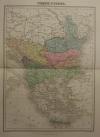
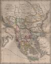
thmbnail of Turquie D´EuropeTurquie D´Europe
by Migeon, Sengteller, Desbuissons
188128 X 40 cm52 euro
thmbnail of Hongarije, Transsylvanië, Bulgarije, MacedoniëHongarije, Transsylvanië, Bulgarije, Macedonië
by Sebastian Munster
1575ca19 X 15,5 cm156 euro
thmbnail of Ungarn und GalizienUngarn und Galizien
by A. Brandrupp, Ch. Peip, M. Oschmann
189648 X 39 cmsold
information about map on atlasandmap.com
thmbnail of Kaart   Polen, Galizien, Ungern, Kroatien, Siebenbürgen, Moldau och Wallachiet.Kaart Polen, Galizien, Ungern, Kroatien, Siebenbürgen, Moldau och Wallachiet.
by Stieler
186822,5 X 21 cmsold
information about map on atlasandmap.com
thmbnail of Europeesch-Turkije en GriekenlandEuropeesch-Turkije en Griekenland
by Emrik & Binger
187223 X 28,5 cmsold
information about map on atlasandmap.com
thmbnail of Europisch Turkije en GriekenlandEuropisch Turkije en Griekenland
by A. Baedeker
185026,5 X 21,5 cmsold
information about map on atlasandmap.com
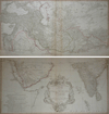
thmbnail of Premiere Partie de la Carte d´Asie Contenant la Turquie, l´Arabie, la Perse, l´IndPremiere Partie de la Carte d´Asie Contenant la Turquie, l´Arabie, la Perse, l´Ind
by d Anville, de la Haye
175177 X 73 cmsold
information about map on atlasandmap.com

Maps of regions in Oman on atlasandmap.com
RegionTitle/MakerYearMeasuresPrice

Arabië Zuidelijk
by Kuyper (Kuijper)
188220 X 15,5 cm47 euro

Hongarije, Zevenburgen, Galicië enz
by Kuyper (Kuijper)
188020 X 15,5 cm19 euro

Imperii Romani
by Félix Delamarche
183239 X 26 cm cmsold

Plans of cities in Oman on atlasandmap.com
TownTitle/MakerYearMeasuresPrice

Die Veteranische Höhle
by nn
1850ca16 X 13 cm37 euro
Braila
Braila - the lazaretto
by nn
1880ca14 X 10,5 cm16 euro
Mehadia:
2 items
Visit our page of the city of Mehadia
Sulina
Sulina - Mundung
by nn
1850ca17 X 11,5 cm26 euro
Tulcea
Vue de Tuldscha, sur le Danube
by nn
188122 X 15,5 cm21 euro

HOME - MAPS - PRINTS - BOOKS - INFO
New:
Maps
Kaarten voor de geschiedenis der aardrijkskunde II (2)

Kuyper maps
Gemeente Gouda

Prints
Reinoud IIe agttiende heer van Brederode, door de Utrechtsche Bisschop, David van Bourgondien...

Townplans and views
Roermond: Ruremunda Gelriea opp.

Books and atlasses
FACSIMILE: Gemeente-Atlas van de provincie Friesland 1861

We are on facebook now:
follow us on facebook
for news, highlighted special items and items on your dutch roots.


sitemap | recent added | inspired by: kruisbestuiving: benut kennis optimaal - www.kuisbestuiving.nl | contact | RSS | | privacy